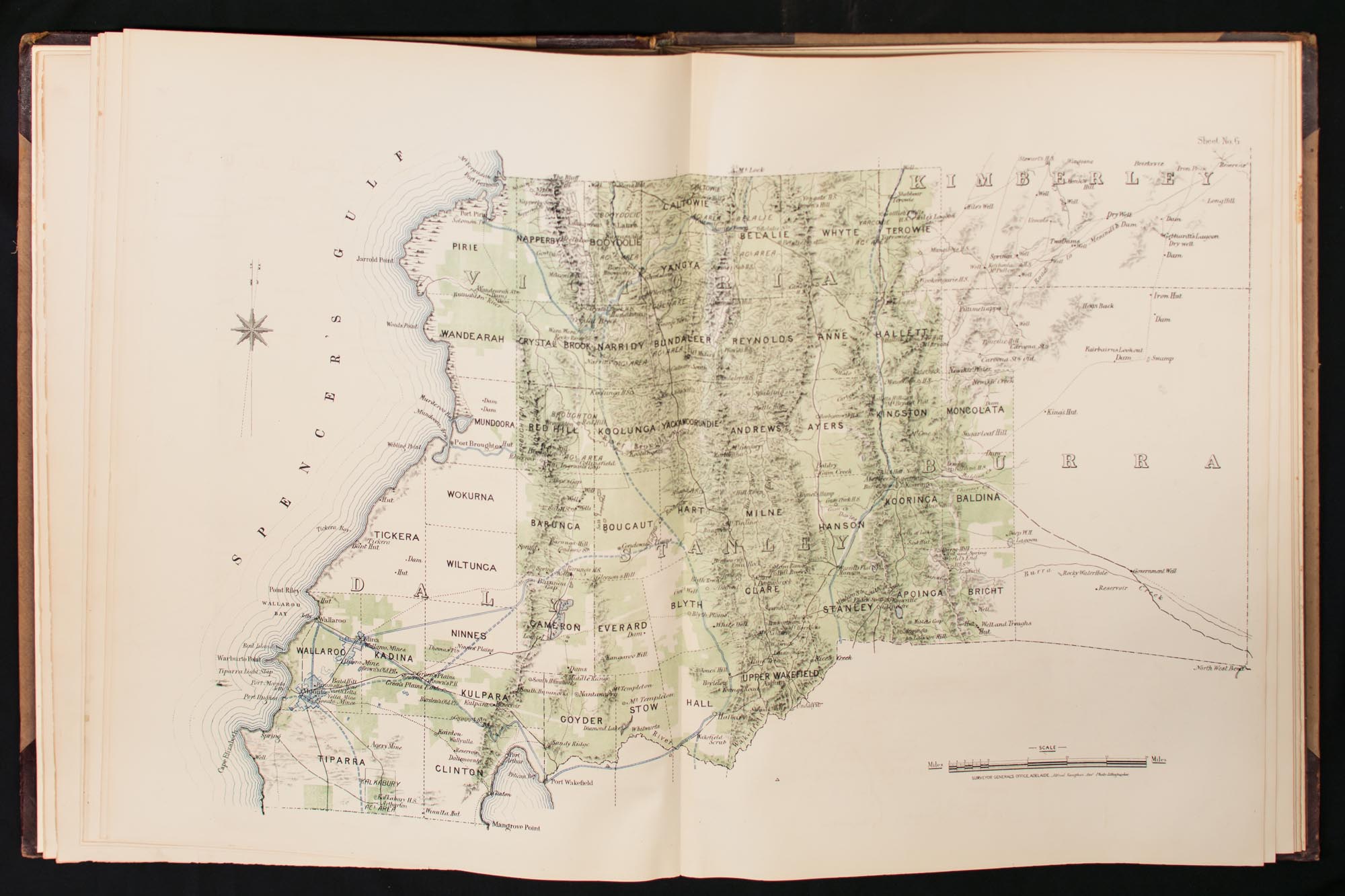
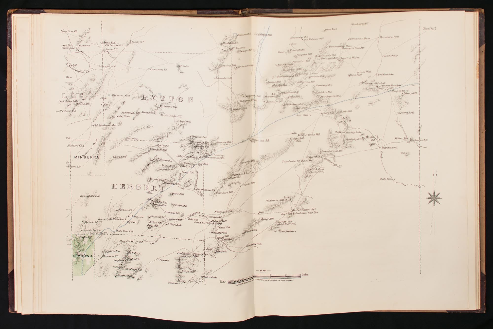
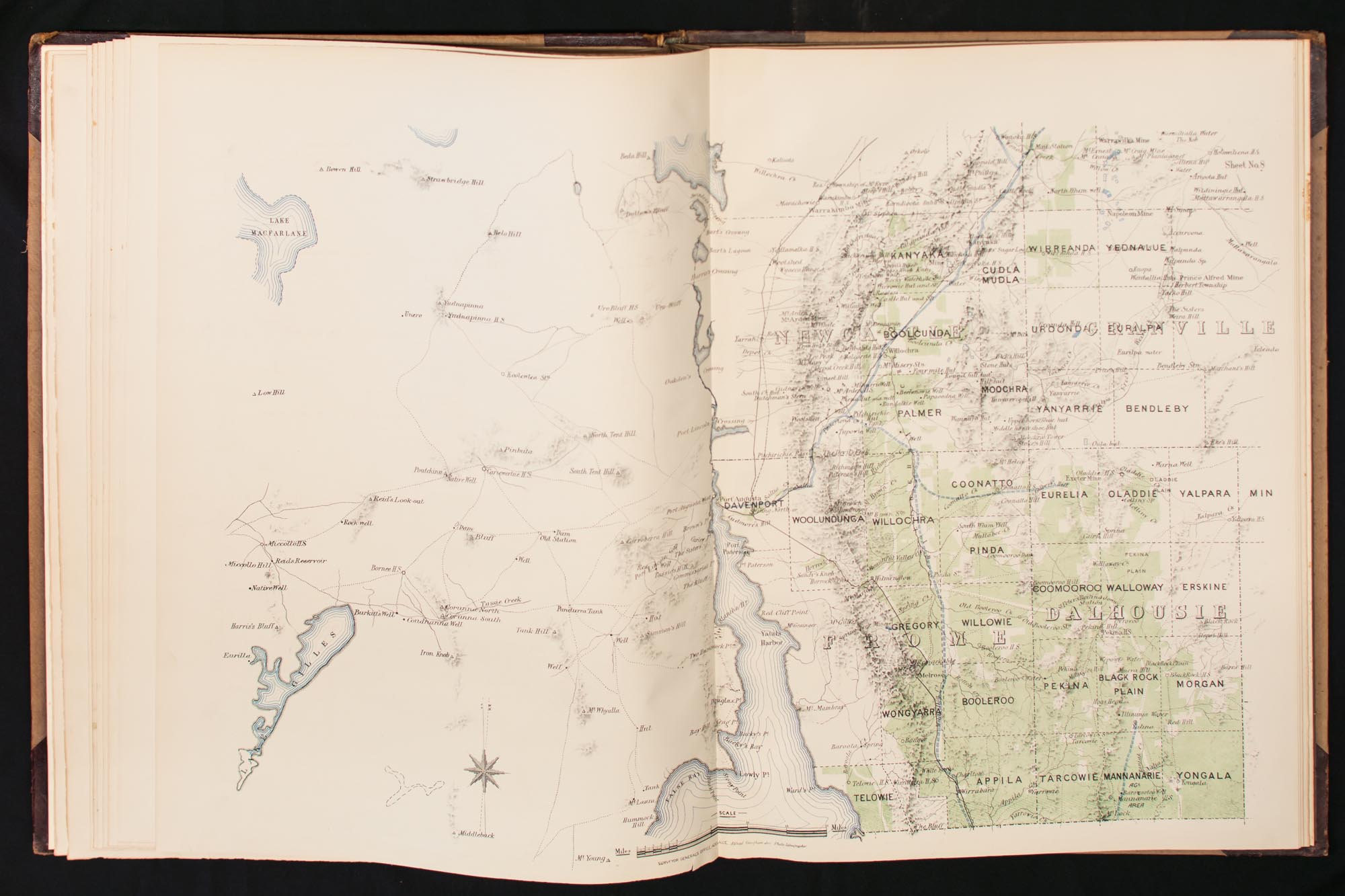
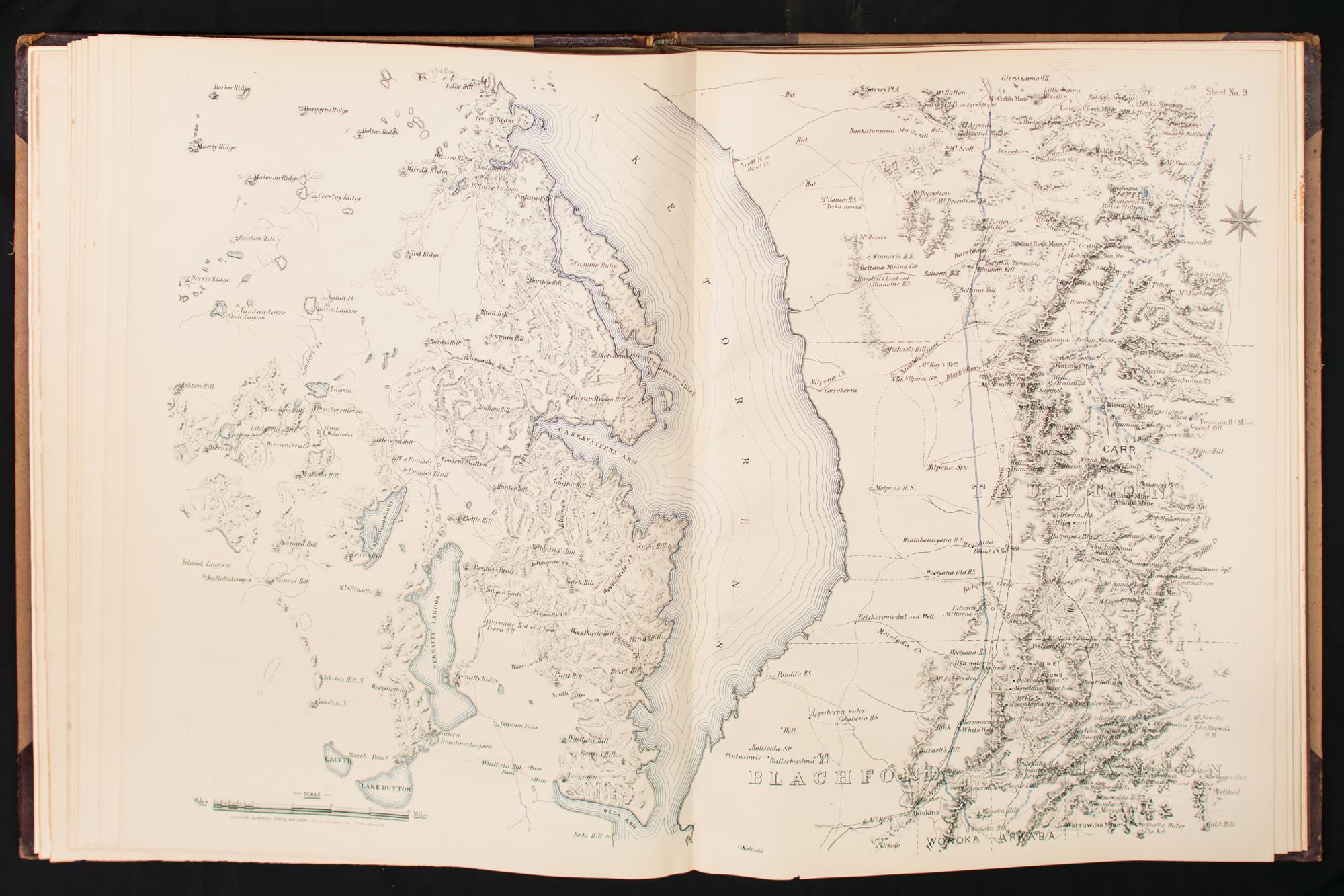
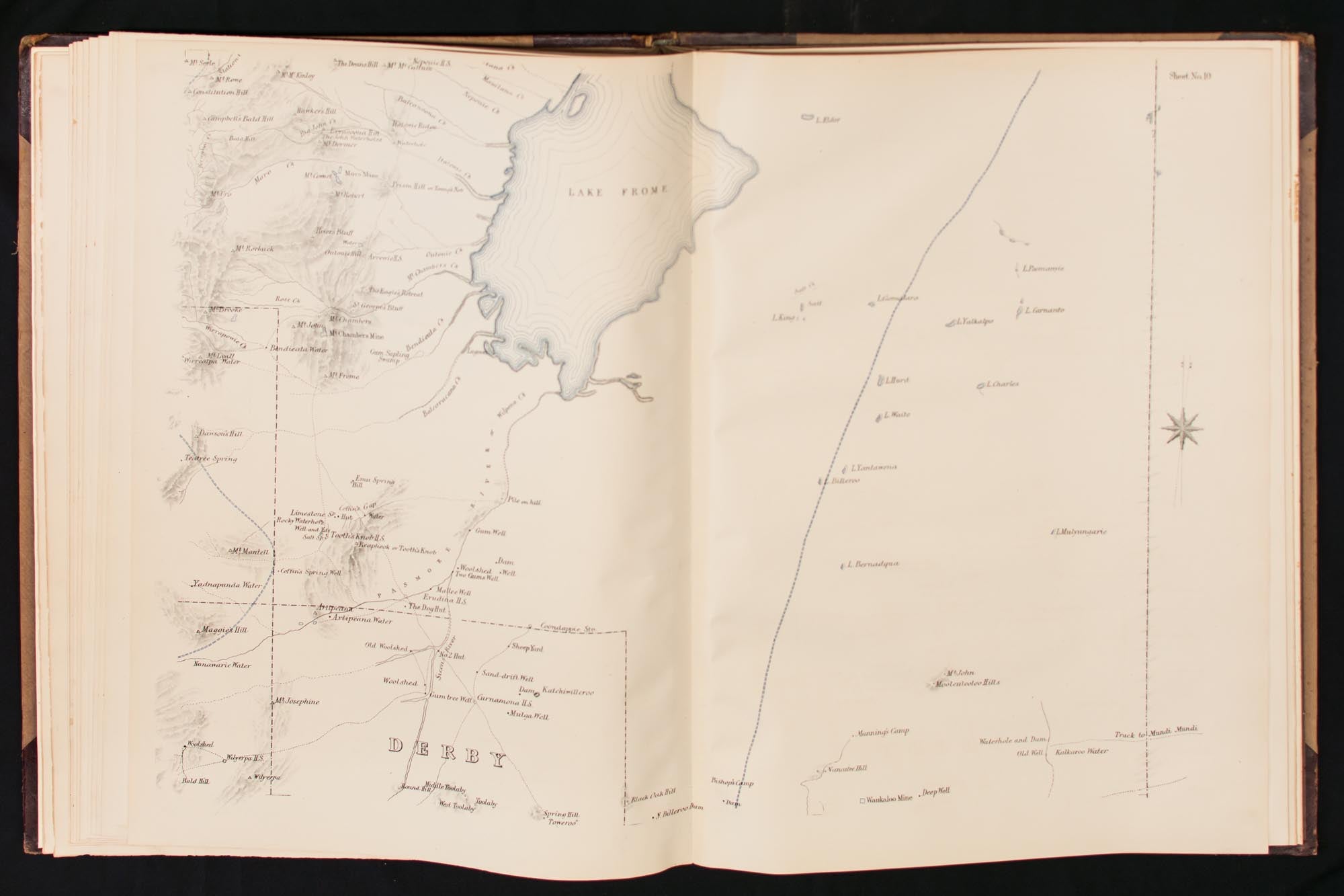
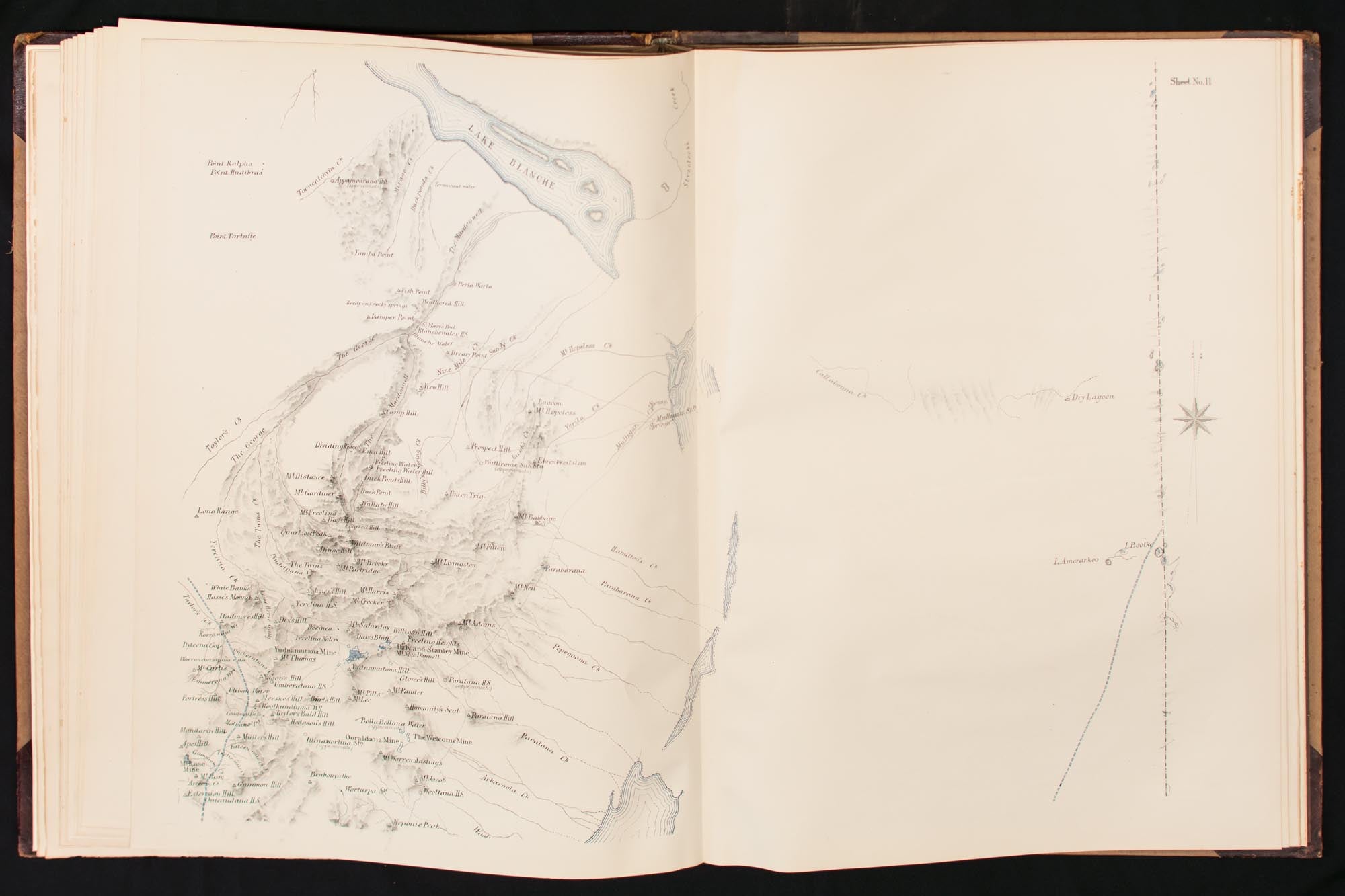

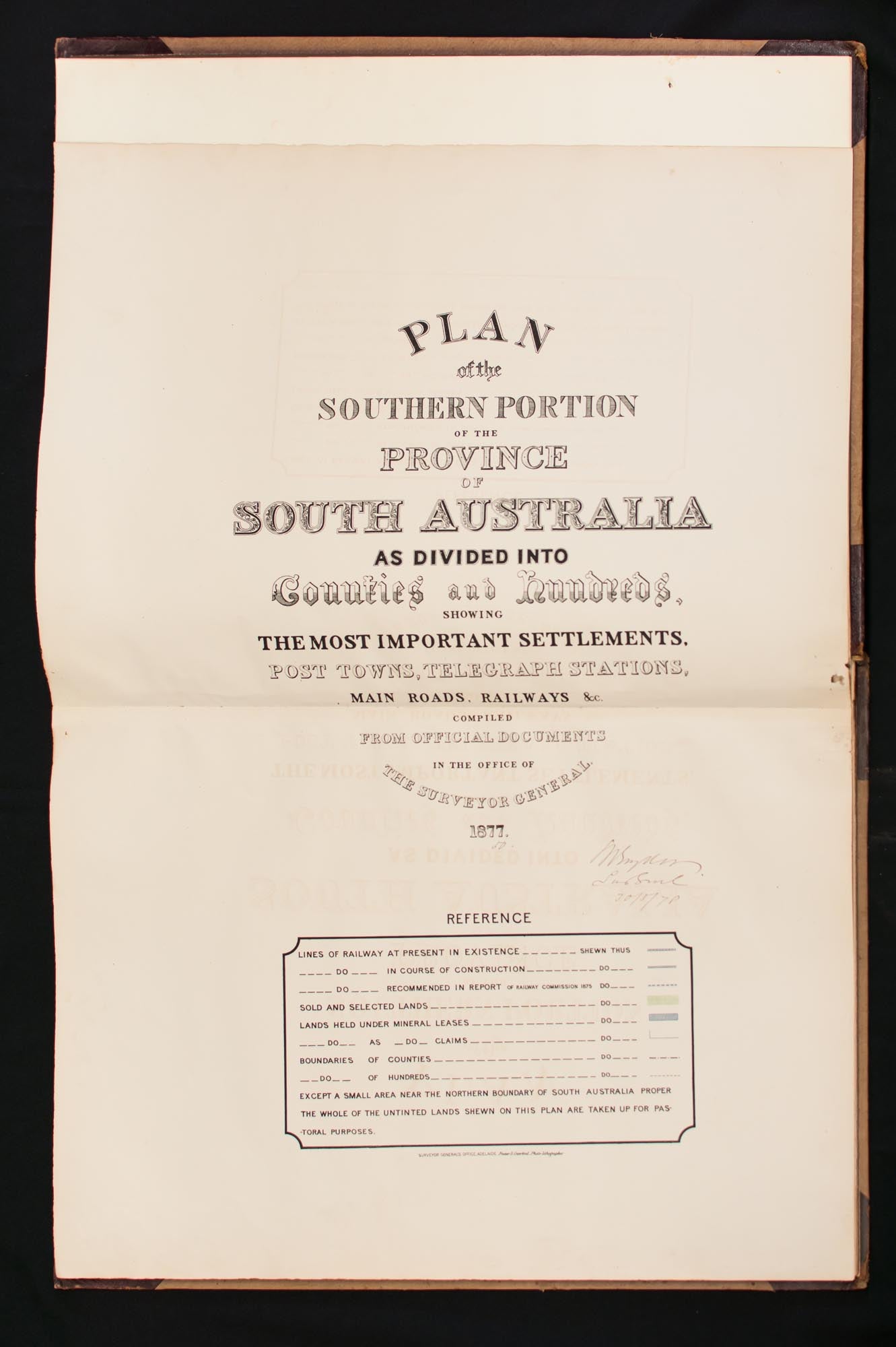
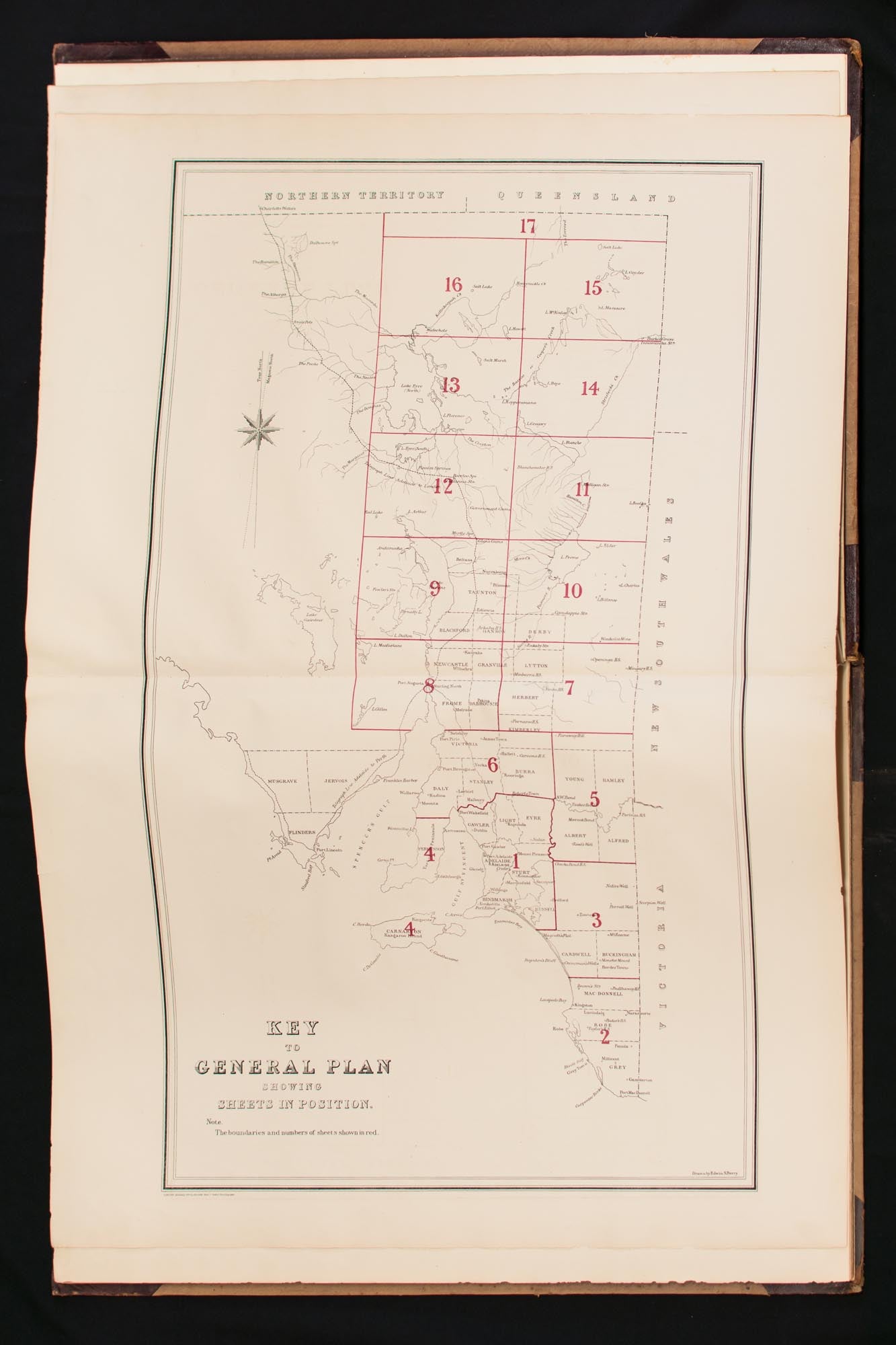
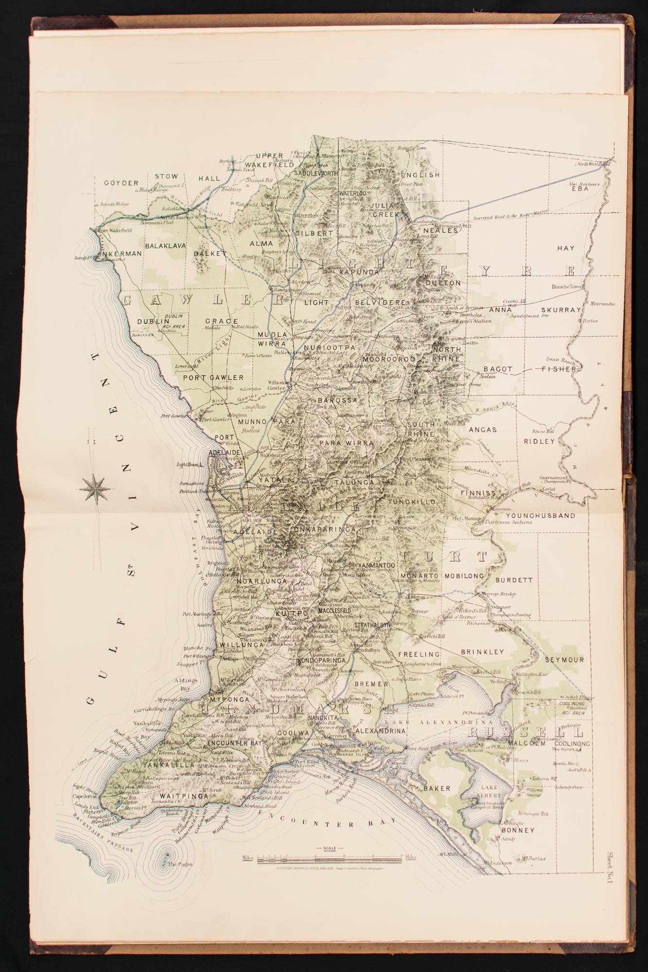
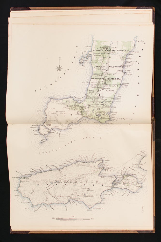
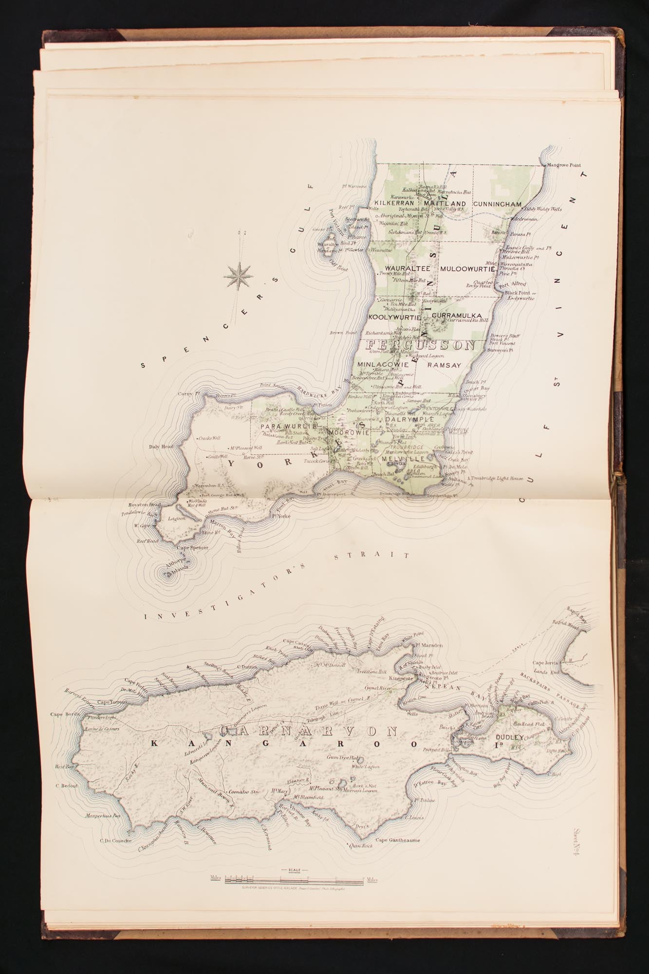
Plan of the Southern Portion of the Province of South Australia as divided into Counties and Hundreds, showing the most Important Settlements, Post Towns, Telegraph Stations, Main Roads, Railways &c. Compiled from Official Documents in the Office of the Surveyor General
Adelaide, Surveyor General's Office, 1877.
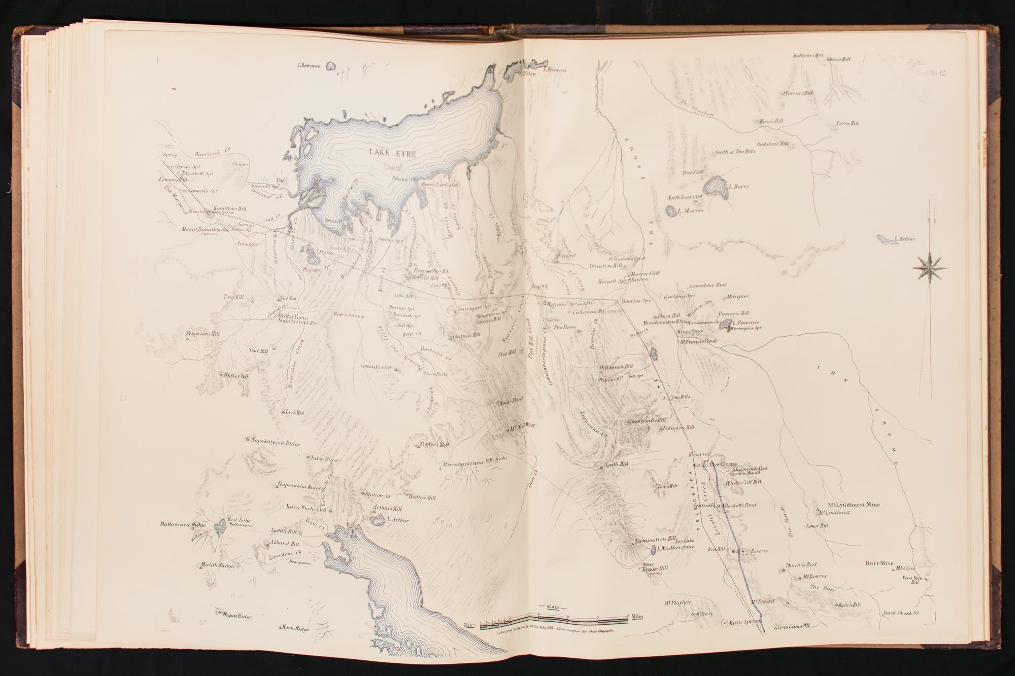
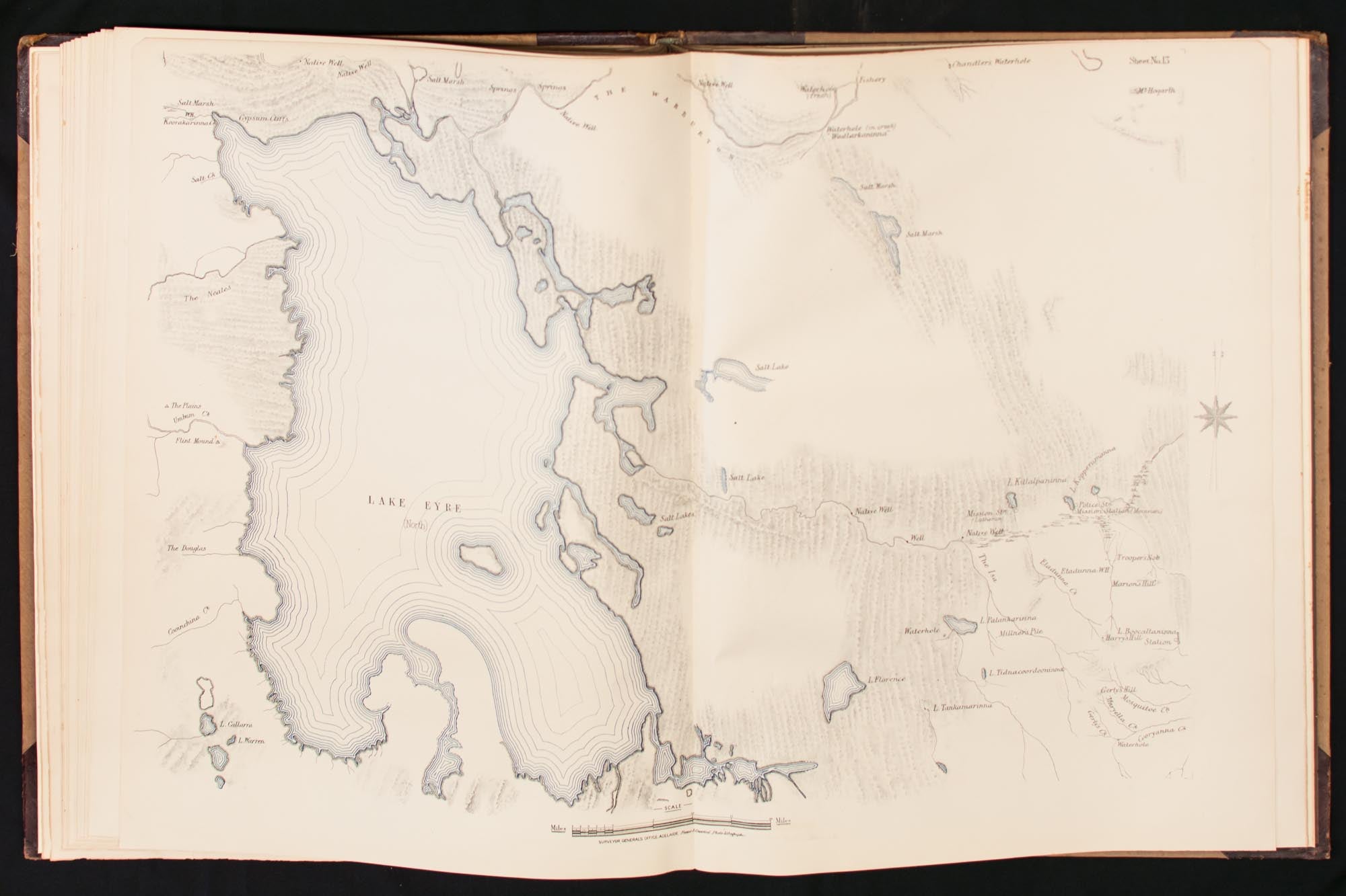
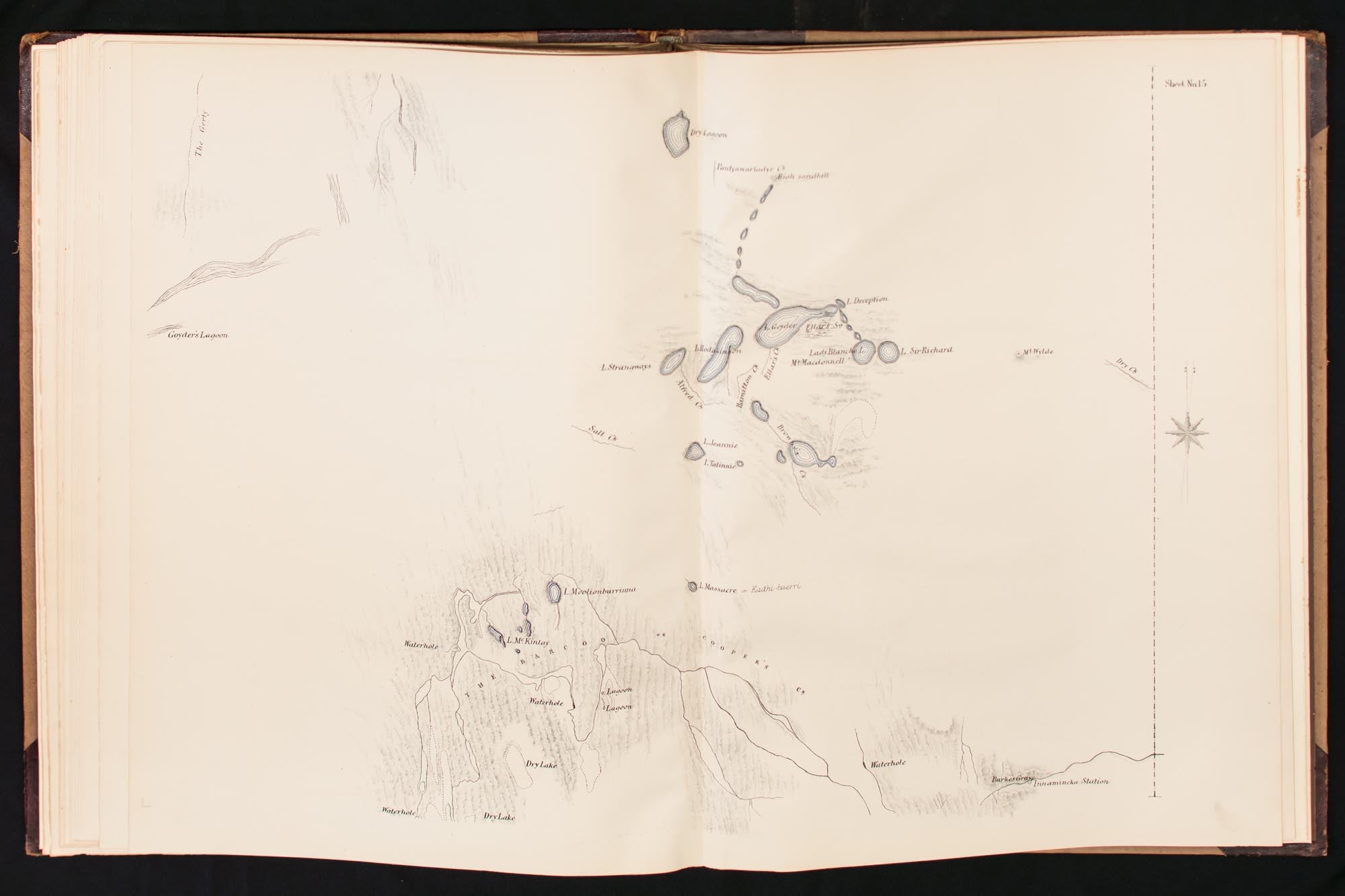
Elephant folio, [78] pages (title, key to maps plus 17 maps, all double-page, three-colour, and printed rectos only).
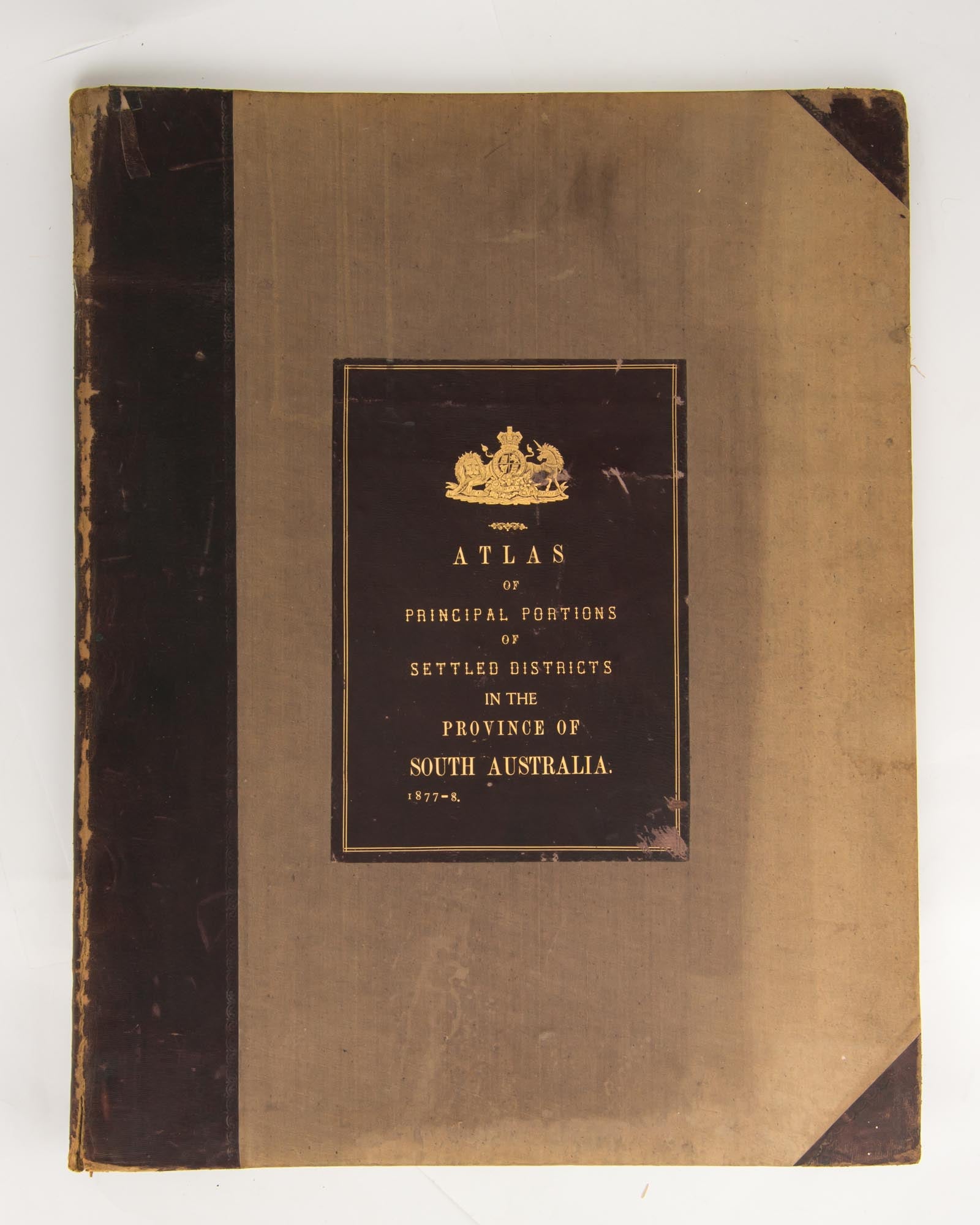
Original half dark brown morocco and light brown watered cloth with a very large leather title-label on the front cover (310 × 220 mm, lettered in gilt 'Atlas of Principal Portions of Settled Districts in the Province of South Australia, 1877-8'); leather rubbed at the extremities (heavily in places), with some wear to the corners and some loss to the rear of the rear top corner; the front joint is cracked towards the foot, and split at the end (but still very firm); the cloth is a little marked, unevenly sunned (heavily in places), with minor wear to the leading edges. The title leaf and the last two maps have a few small areas damaged by silverfish expertly restored (confined to unprinted areas in the margins, with the only loss of print being the word 'Miles' from one scale); the first three sheets have minimal inoffensive nibbling to some edges; one map has two clean creases and a tiny sealed burst to a blank area; a handful of short edge tears (caused by inexpert opening of this large volume) have also been expertly sealed; these trifling blemishes do not detract from this rare and impressive atlas.
Lithographed throughout by Frazer S. Crawford (Government Printer); signed on the double-page title 'G.W. Goyder Sur Genl 30/5/78' with a two-digit number (50 in this case) in his hand under the date - presumably the copy number of what we suggest was a very limited print run, given the lavishness of the production. [We have previously sold a copy signed by Goyder on the same date, with the number 34.] The atlas was prepared under the direction of the man who, as Surveyor-General from 1861 to 1894, 'served under 24 different Commissioners of Crown Lands, through 34 changes of Ministry and helped to amend over 60 land acts' ('Australian Dictionary of Biography'). Provenance: 'Sir E.T. Smith's Copy' is pencilled in the verso of the front flyleaf, along with the date '1920' and some pricing codes, so it may have entered the trade after the death in late 1919 of Sir Edwin Thomas Smith (1830-1919), the South Australian brewer, philanthropist and politician. It subsequently entered the Glover collection; it has the armorial bookplate of Charles R.J. Glover on the pastedown, and the part-title 'SA 1877' in white ink on the spine (a Glover tradition).
Item #89621
Sold