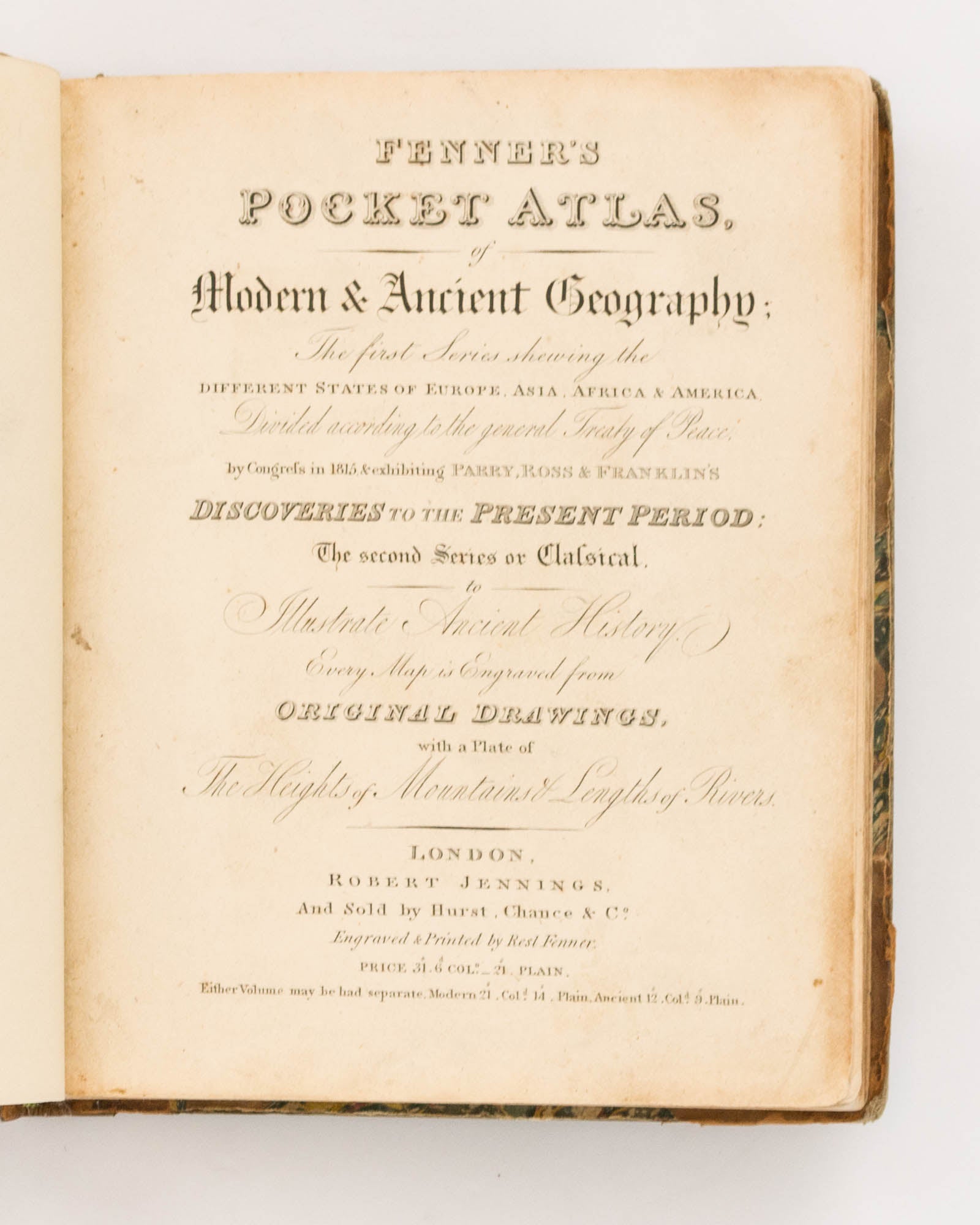
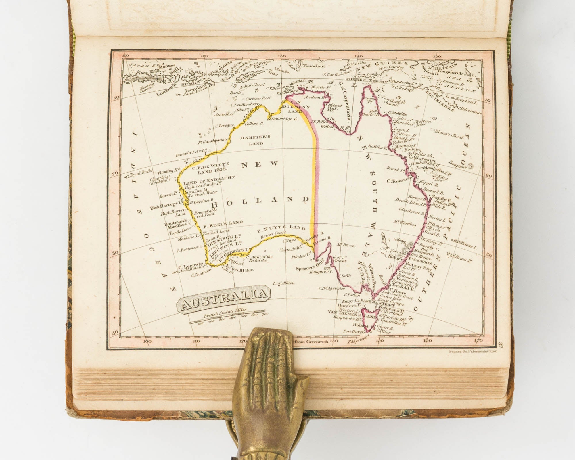
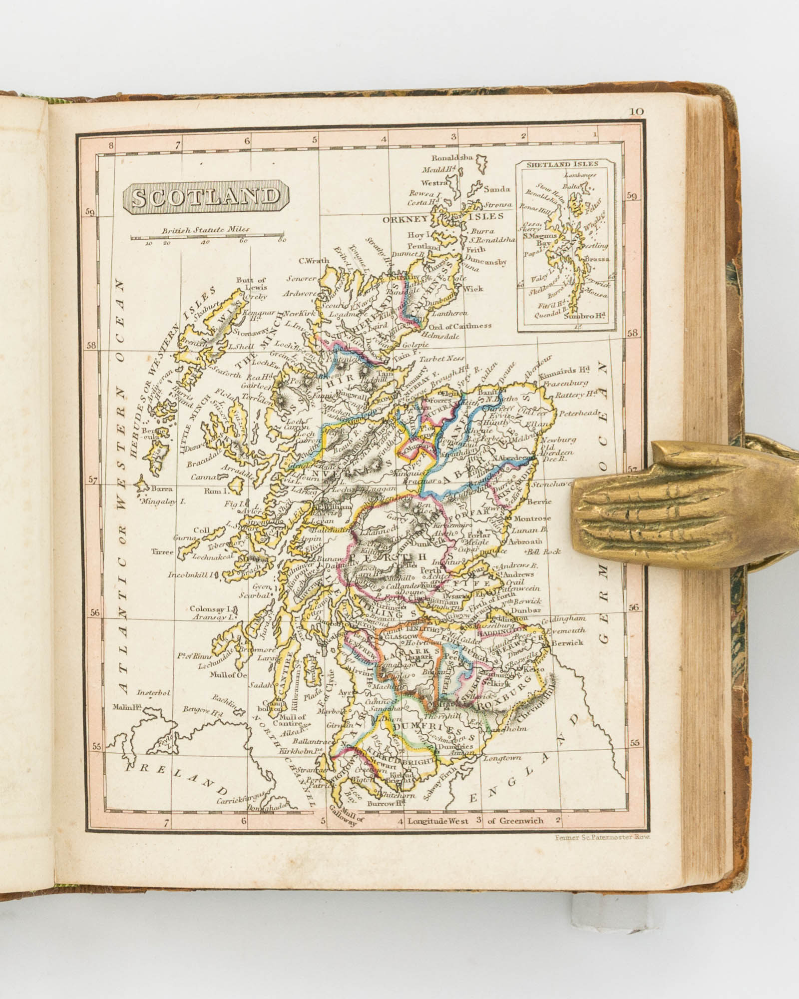
Fenner's Pocket Atlas of Modern & Ancient Geography. The First Series shewing the different States of Europe, Asia, Africa & America, divided according to the General Treaty of Peace, by Congress in 1815 & exhibiting Parry, Ross & Franklin's Discoveries to the Present Period. The Second Series or Classical, to illustrate Ancient History...
London, Robert Jennings ('Engraved & Printed by Rest Fenner'), 1828 (only the second series is dated).
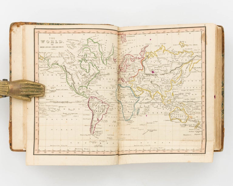
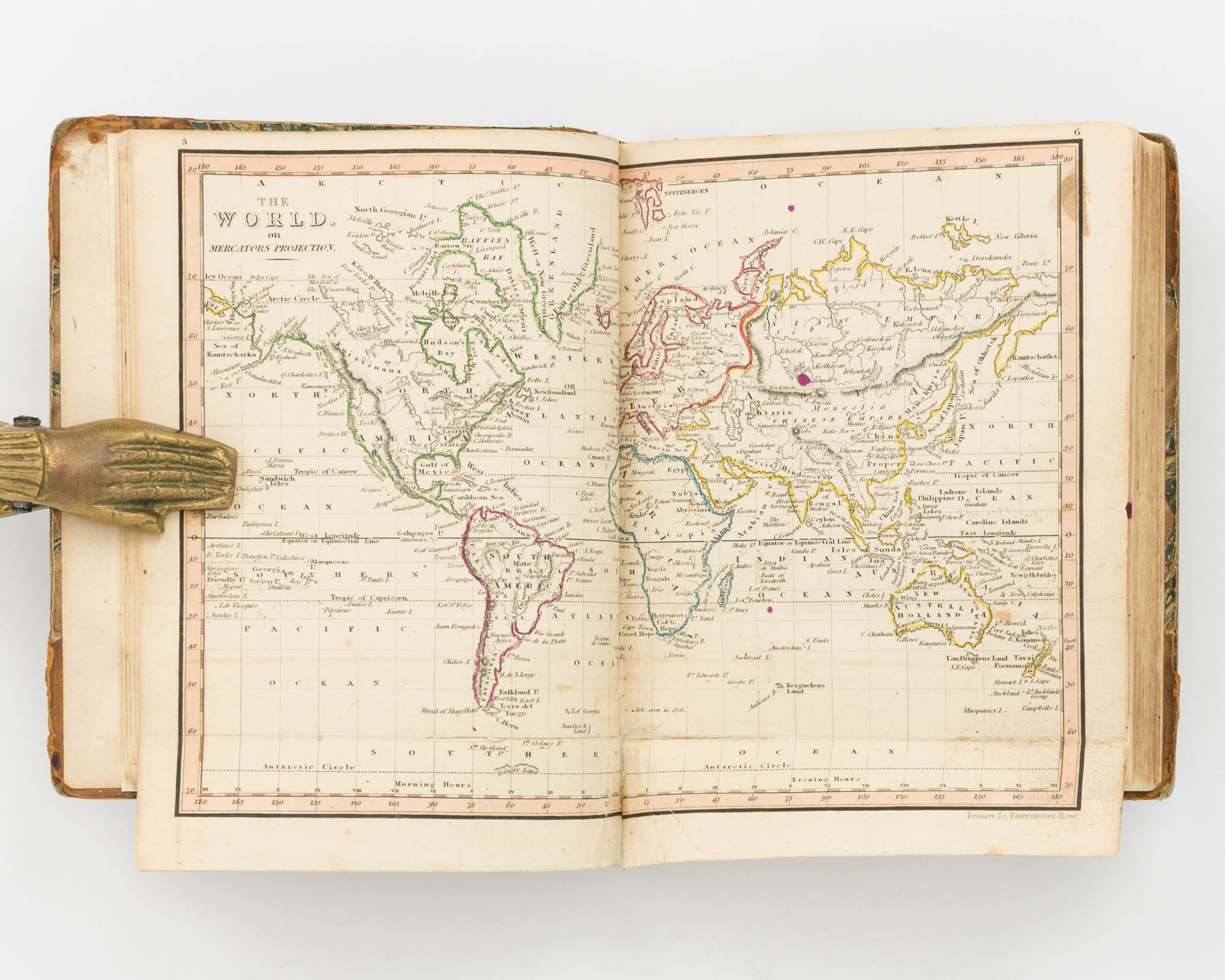
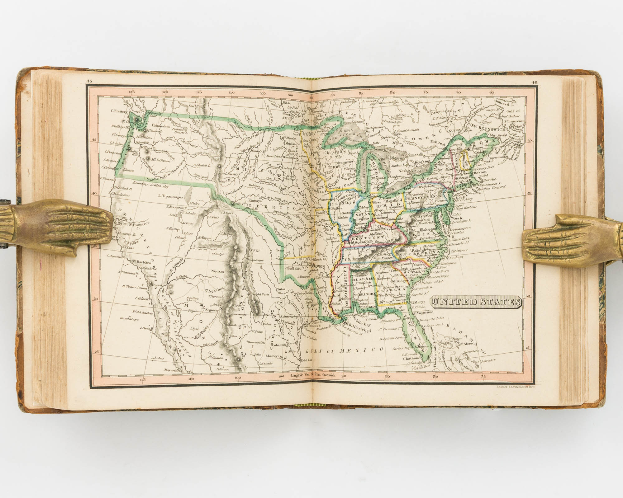
Small square octavo (165 × 143 mm), two parts bound as one, comprising an engraved title leaf, contents leaf, 53 maps (including 6 double-page maps numbered as 12 maps, one folding), and a double-page plate showing 'A Comparative View of the Heights of the Principal Mountains & Lengths of the Principal Rivers of the World' (numbered 54 and 55, but bound in immediately after the contents leaf) (the First Series, 'Modern'); and an engraved title leaf and 26 maps, including one double-page map numbered as two (the Second Series, 'Ancient'). All versos are blank; the plate and all 79 maps are hand-coloured.
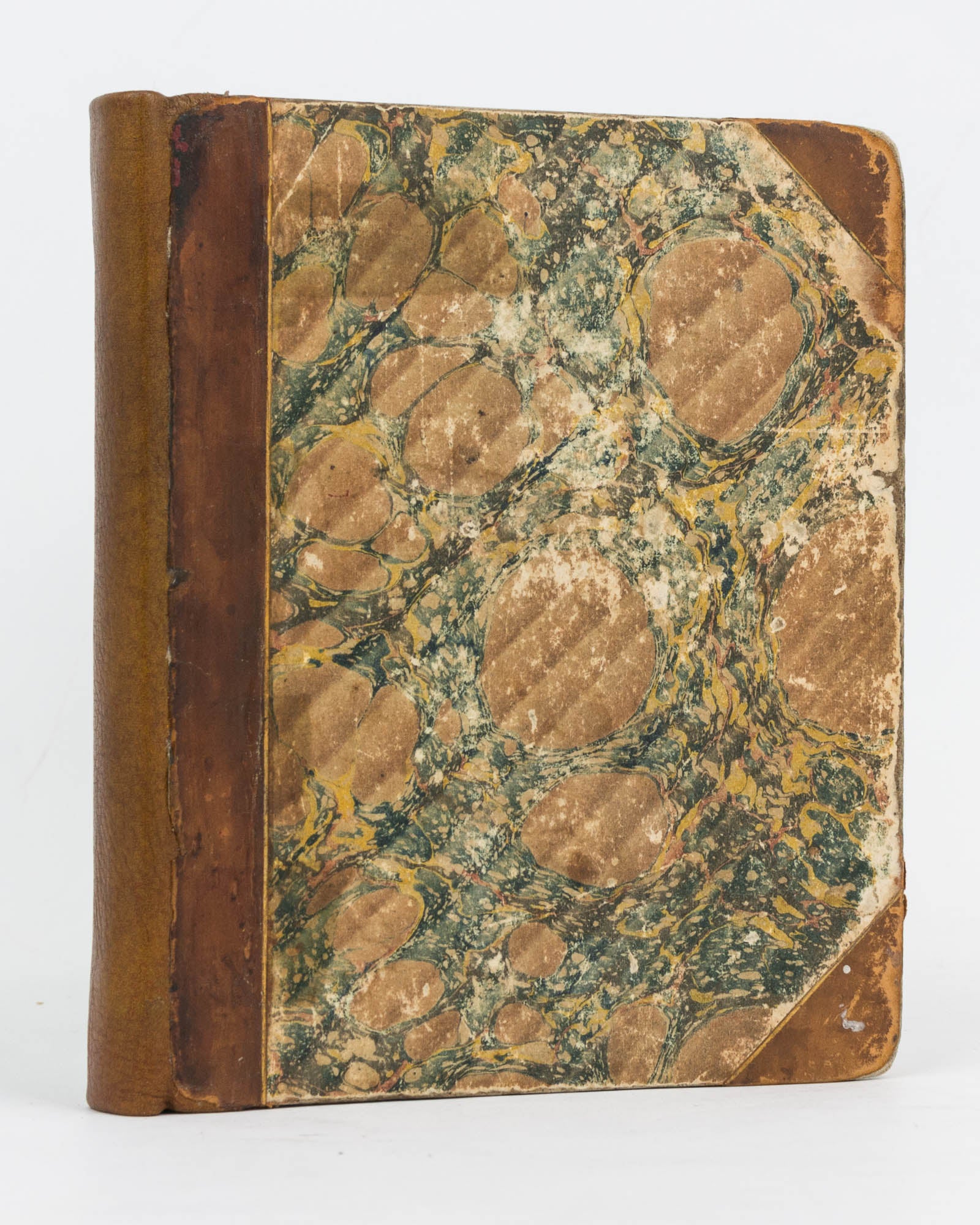
Early half calf and marbled papered boards, recently rebacked; covers a little worn and scuffed; a few marks and other signs of use internally; minimal conservation to the folding map (light reinforcement to the verso of the folds, with a couple of tiny sealed tears to one edge); plate numbers occasionally shaved; a very good copy with a contemporary armorial bookplate ('Fidelis esto ad mortem') on the front pastedown.
The attractive hand-coloured issue of this pocket atlas. The title page advertises 'Price 31s 6d Col[oure]d. 21s Plain. Either Volume may be had separate ...'.
Item #124818
Sold