![Item #122940 AAF Cloth Map [Miscellaneous Maps Series]. C-47 South Borneo [recto]. [Together with] C-48 West Java [verso]. Advance Edition. Maps: South-West Pacific Area.](https://treloars.cdn.bibliopolis.com/pictures/122940_01.jpg?width=768&height=1000&fit=bounds&auto=webp&v=1620114128)
![AAF Cloth Map [Miscellaneous Maps Series]. C-47 South Borneo [recto]. [Together with] C-48 West Java [verso]. Advance Edition](https://treloars.cdn.bibliopolis.com/pictures/122940_02.jpg?auto=webp&v=1620114128)
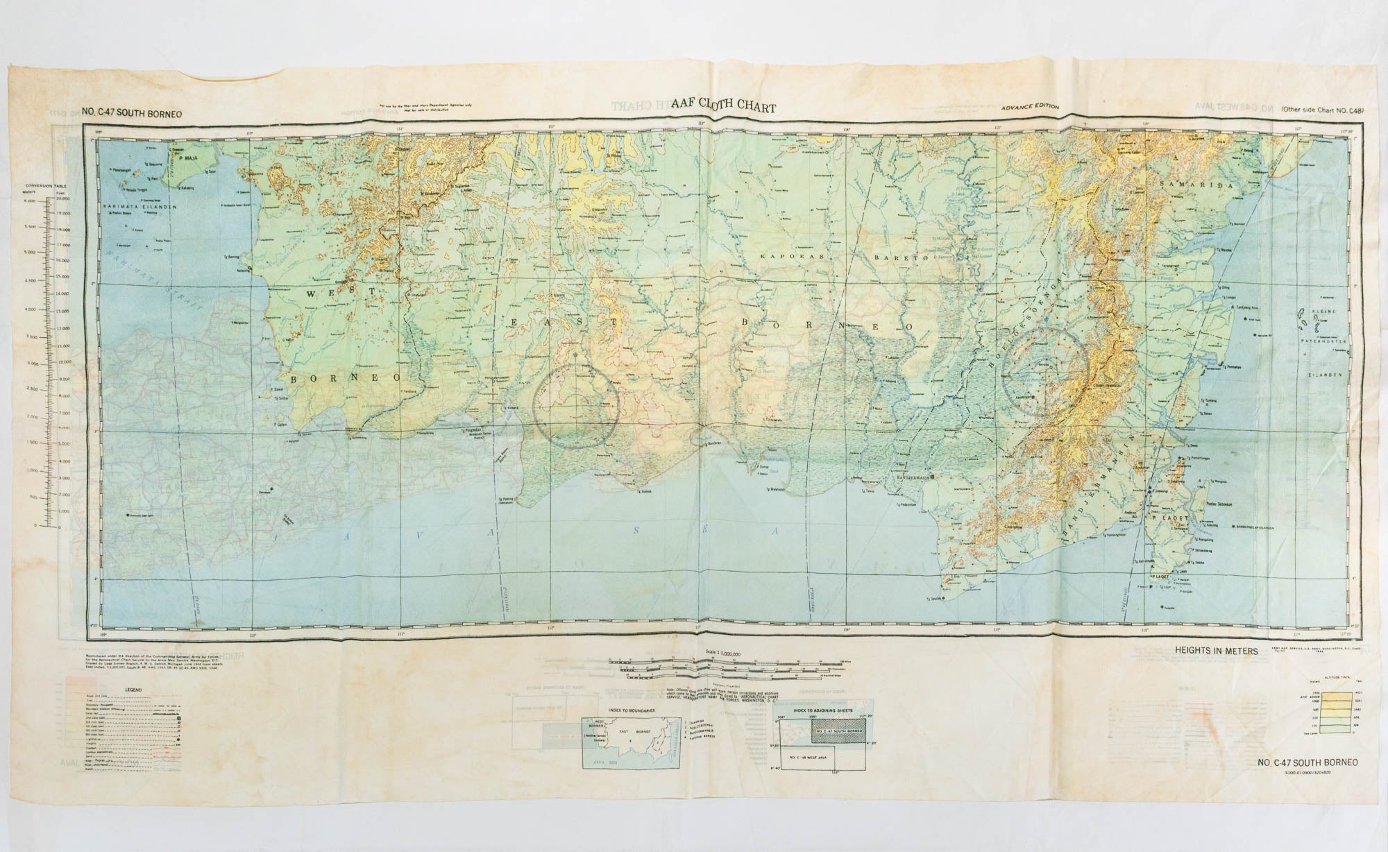
AAF Cloth Map [Miscellaneous Maps Series]. C-47 South Borneo [recto]. [Together with] C-48 West Java [verso]. Advance Edition
Washington DC, Army Map Service (for the Aeronautical Chart Service), June 1944.
Two large-format full-colour maps, printed on the recto and verso of a piece of silk (external dimensions approximately 540 × 995 mm; approximate printed surfaces approximately 357 × 910 mm and 357 × 864 mm respectively).
Lightly creased generally, as well as where folded, with a few light marks and areas of discolouration; in very good condition.
These silk 'escape or evasion' maps were issued primarily for use by air force personnel.
Item #122940
Sold
See all items in
Pacific,
Second World War
See all items by Maps: South-West Pacific Area