

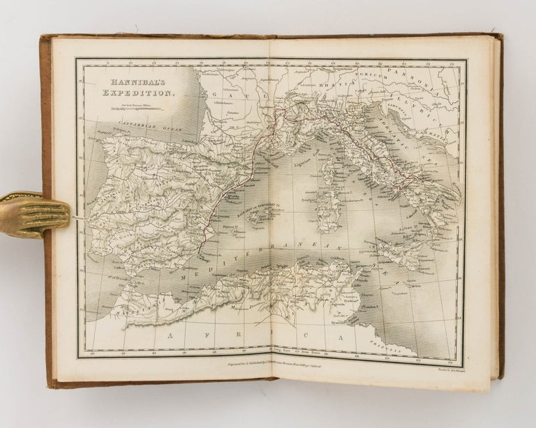
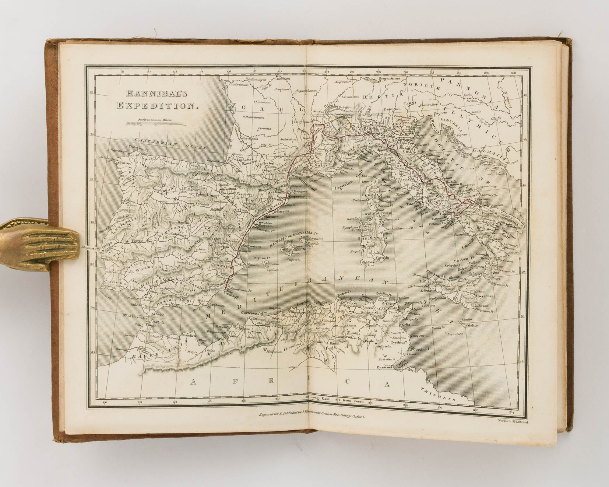
Maps and Plans illustrative of Livy, containing Hannibal's Expedition, Spain, Cisalpine Gaul, Central Italy ... Plan of Rome, Battle at the Caudine Forks ... &c. &c
Oxford, J. Vincent, [circa 1826].
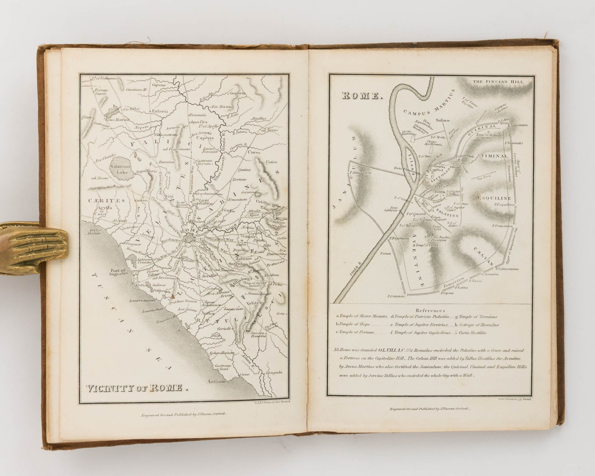
Octavo, [viii] (letterpress publisher's catalogue), engraved title leaf, 10 maps and plans (7 of them double-page with routes coloured red), 8 battle plans (2 of them double page), and 7 pages of plates; the plates and maps, engraved by G.J. and J.N. Neele, are mounted on guards.
Original cloth with an engraved paper title-label on the front cover; cloth mottled, unevenly faded and a little worn at the extremities; central gathering a little loose; scattered light foxing; minor signs of use and age; overall a very good copy.
One of several small compendia of maps and plates published by J. Vincent for students of the classics at the University of Oxford. This volume is principally concerned with the Punic Wars, in particular Hannibal's campaigns in Italy.
Item #122051
Sold