![Item #116393 Fox Hunting Map of Wiltshire [cover title]. Map: Fox Hunting.](https://treloars.cdn.bibliopolis.com/pictures/116393.jpg?width=768&height=1000&fit=bounds&auto=webp&v=1573015198)
![Fox Hunting Map of Wiltshire [cover title]](https://treloars.cdn.bibliopolis.com/pictures/116393_2.jpg?auto=webp&v=1571884391)
Fox Hunting Map of Wiltshire [cover title]
London, Longmans & Co., [circa 1850s].
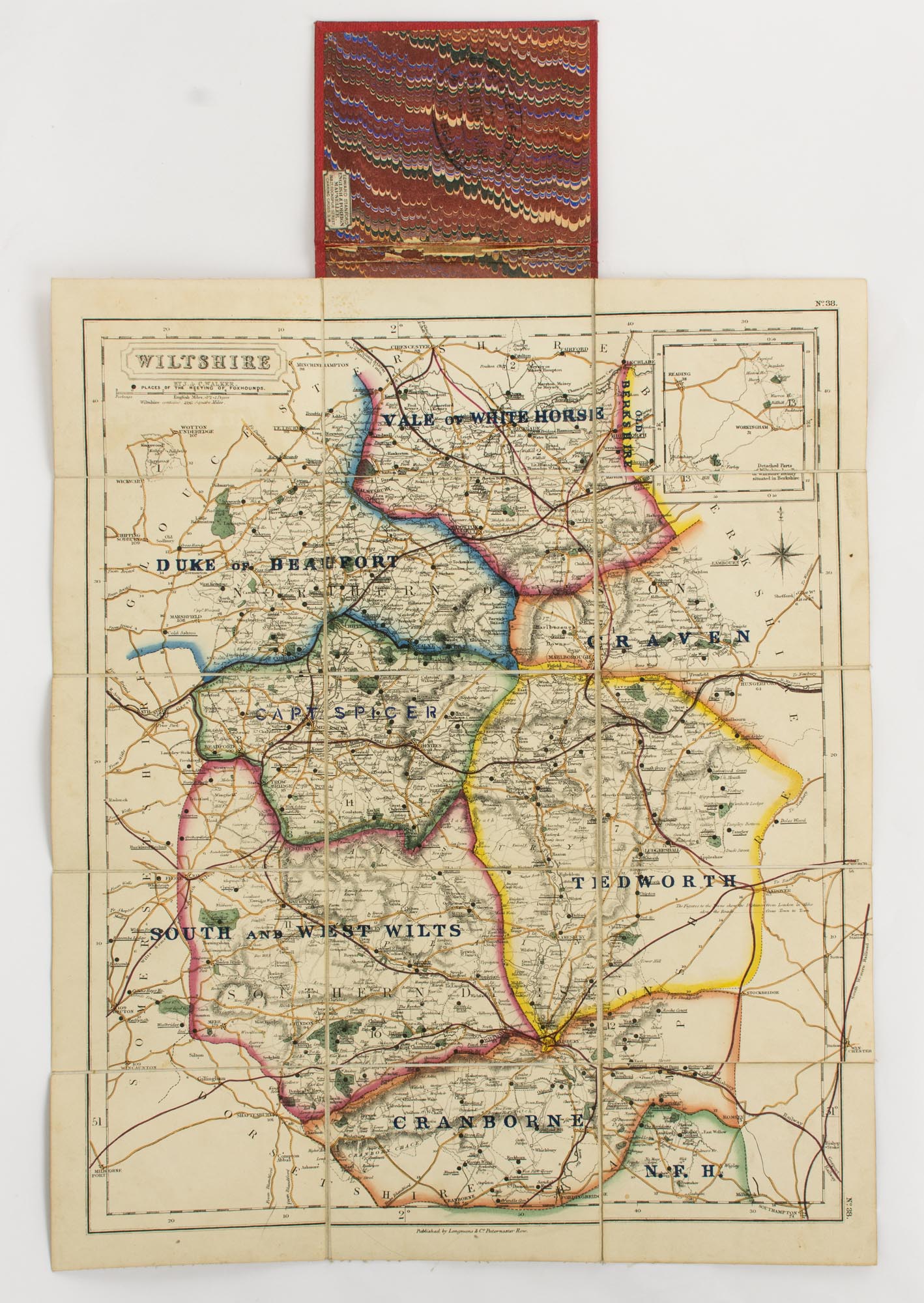
A lithographed map (approximately 400 × 340 mm), extensively hand-coloured in outline, dissected into 15 panels and mounted on linen (as issued), folded and mounted on the inside rear surface of cloth boards (external dimensions 123 × 100 mm).
Red pebble-grain cloth stamped in blind and lettered in gilt; marbled paper on the exposed pastedown and cloth panel of the folded map; ownership stamp on the pastedown and one cloth panel; in excellent condition.
The first issue of this map appeared in 'Hobson's Fox-Hunting Atlas', which comprised county maps from the 'British Atlas' of J. & C. Walker (first published in 1837). This version is a lithographic transfer, taken from the original steel plate engraved by J. & C. Walker, overprinted with 'Places of the meeting of foxhounds' and boundaries of the various hunts. These include the Vale of White Horse, the Craven, the Tiedworth, and the Duke of Beaufort. 'J. & C. Walker' appears under the title, and 'No. 38' is printed in two margins.
Item #116393
Price (AUD):
$220.00