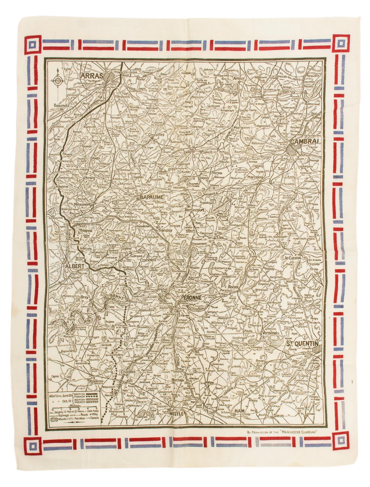
![Item #115167 A linen map of the Western Front, showing the 'Allies' Line June 30 [and] ... Oct. 19' 1916. Battles of the Somme.](https://treloars.cdn.bibliopolis.com/pictures/115167_00.jpg?width=768&height=1000&fit=bounds&auto=webp&v=1561970447)
A linen map of the Western Front, showing the 'Allies' Line June 30 [and] ... Oct. 19' 1916
[London], By Permission of the 'Manchester Guardian', [1916].
A piece of hemmed white linen (overall dimensions 610 × 465 mm), the map (510 × 382 mm) printed in black, within a decorative blue and red border. Apart from a very short inconspicuous right-angled tear (15 × 10 mm) to the map near the bottom righthand corner, the item is in excellent condition. The area depicted is roughly from Arras, Pozieres, Albert and Rosieres-en-Santerre in the west, to Cambrai and St Quentin in the east, with Bapaume and Peronne in between. Both the British and the French front lines are clearly marked, showing the major gains made between June and October. The British 'together with the French ... launched a great offensive on 1 July. On the main front, the British attacks were heavily repulsed, with 60,000 casualties on the first day alone. Over the next few weeks the fighting and killing continued, and the Australians soon became drawn in, with three of their divisions sent to join the struggle.... British attacks on the Somme had brought the front line close to the village of Pozières. There, in darkness on 23 July, the 1st Australian Division made an assault supported by heavy artillery fire. The ruined village was taken in hard and intense fighting and enemy counter-attacks were repelled. The Germans responded by pounding the area with their artillery. The capture of Pozières was a significant achievement, but within five days the 1st Division had lost 5,000 men' (Australian War Memorial).
Item #115167
Sold