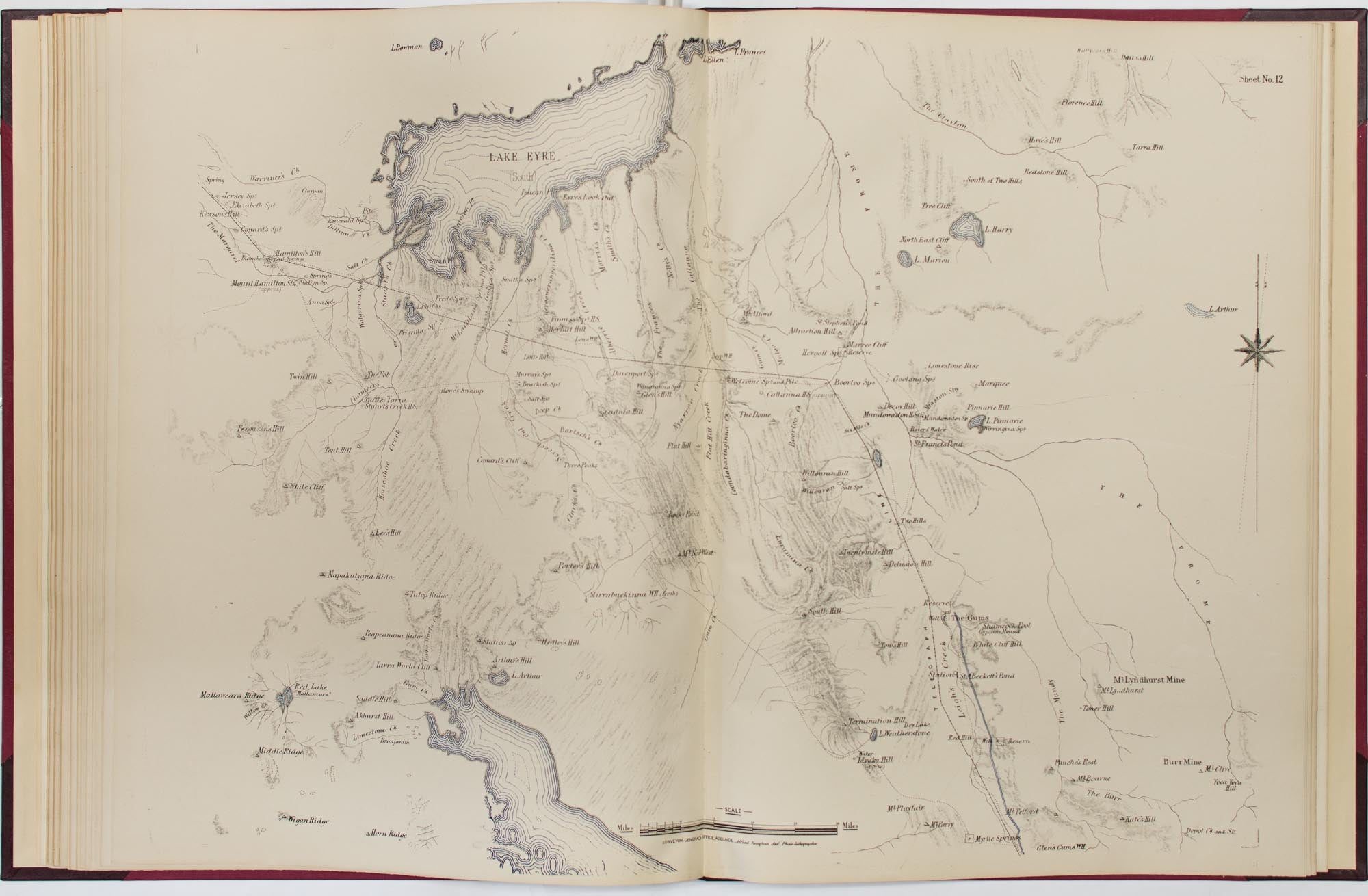
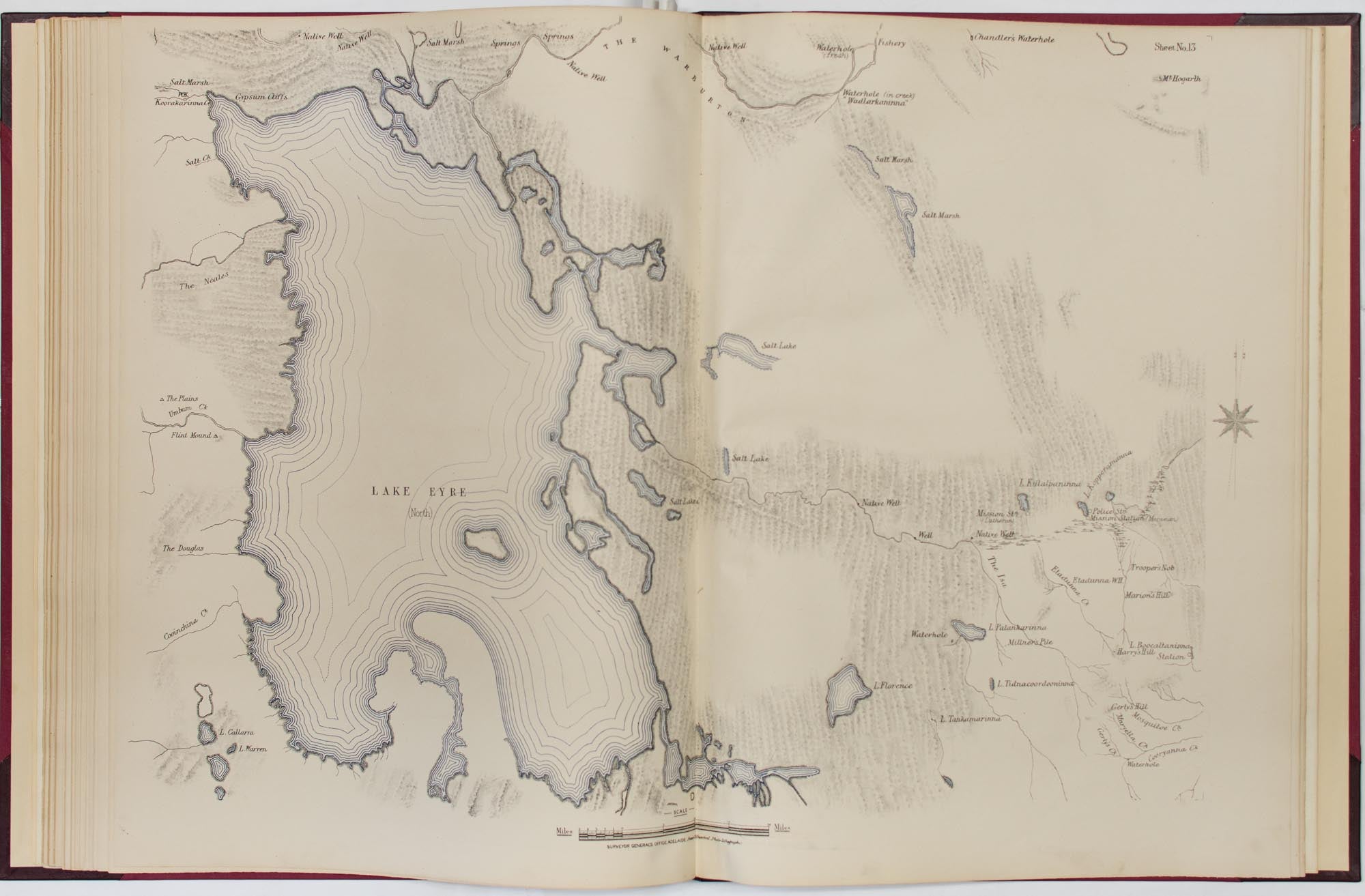
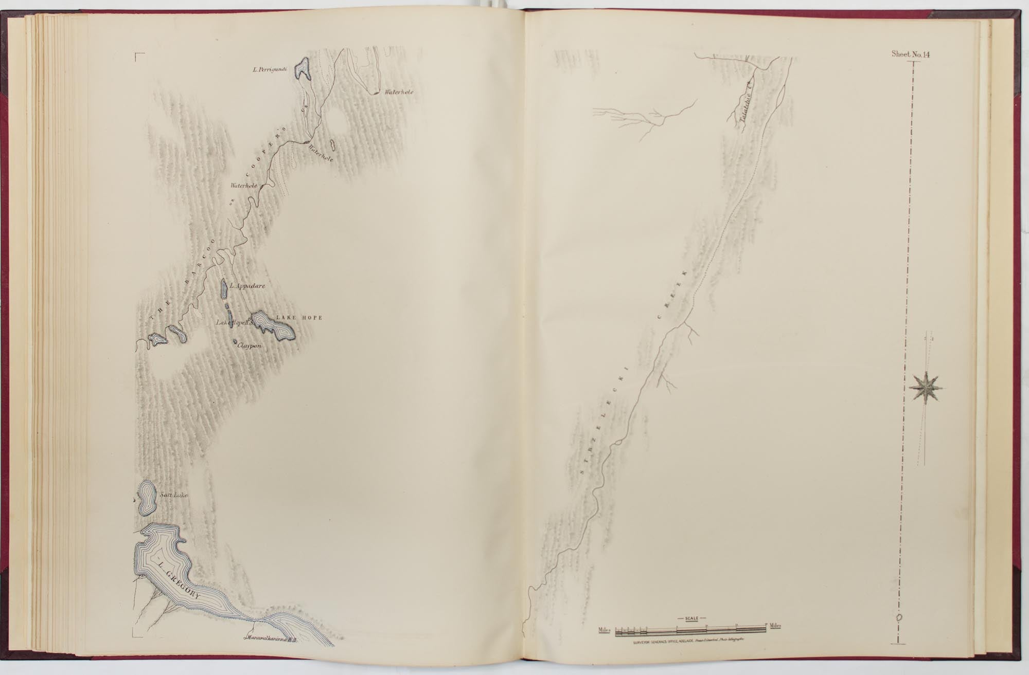
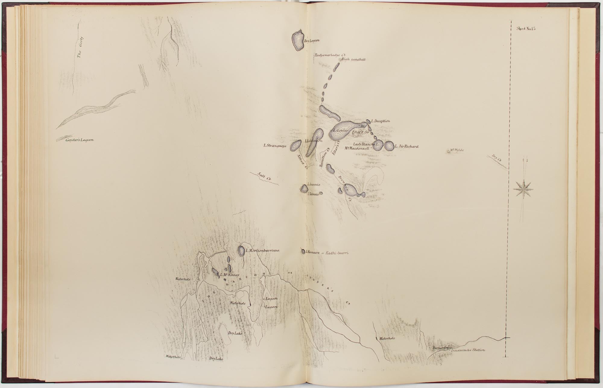
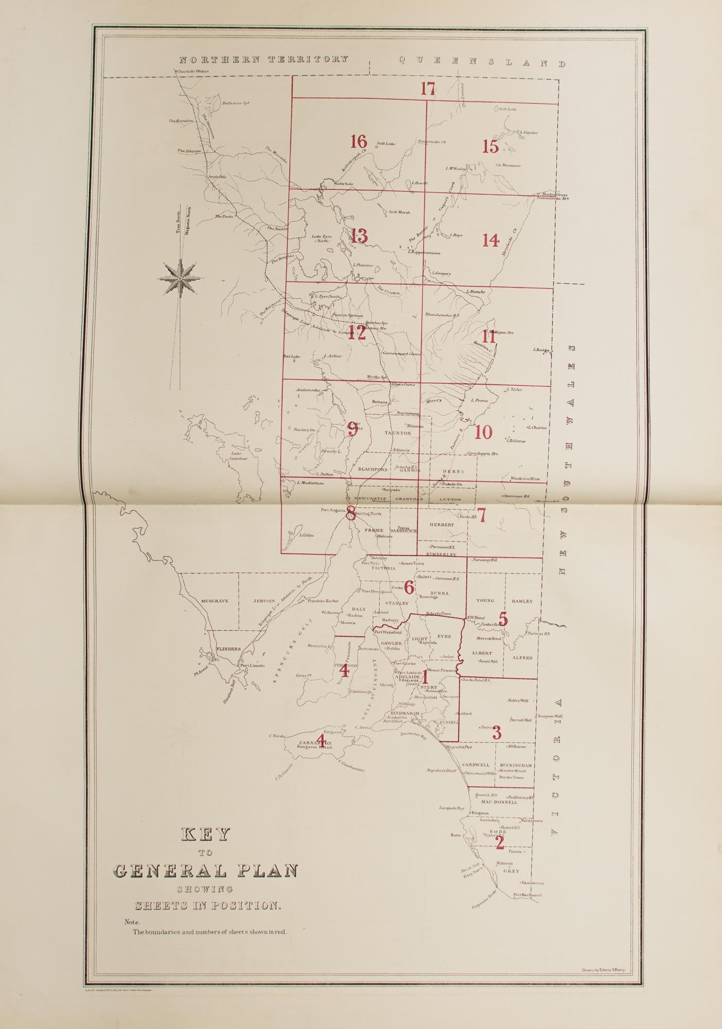

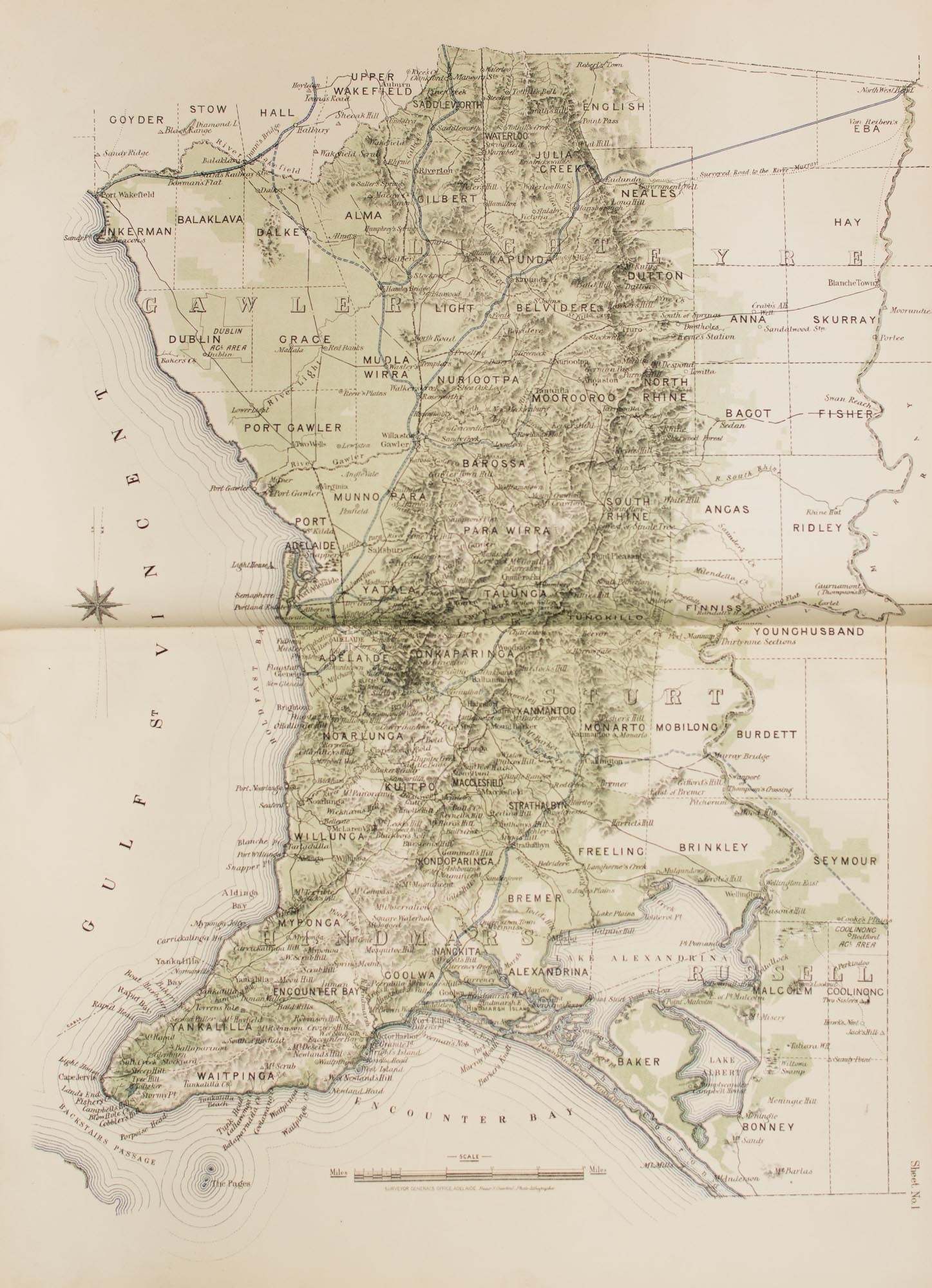
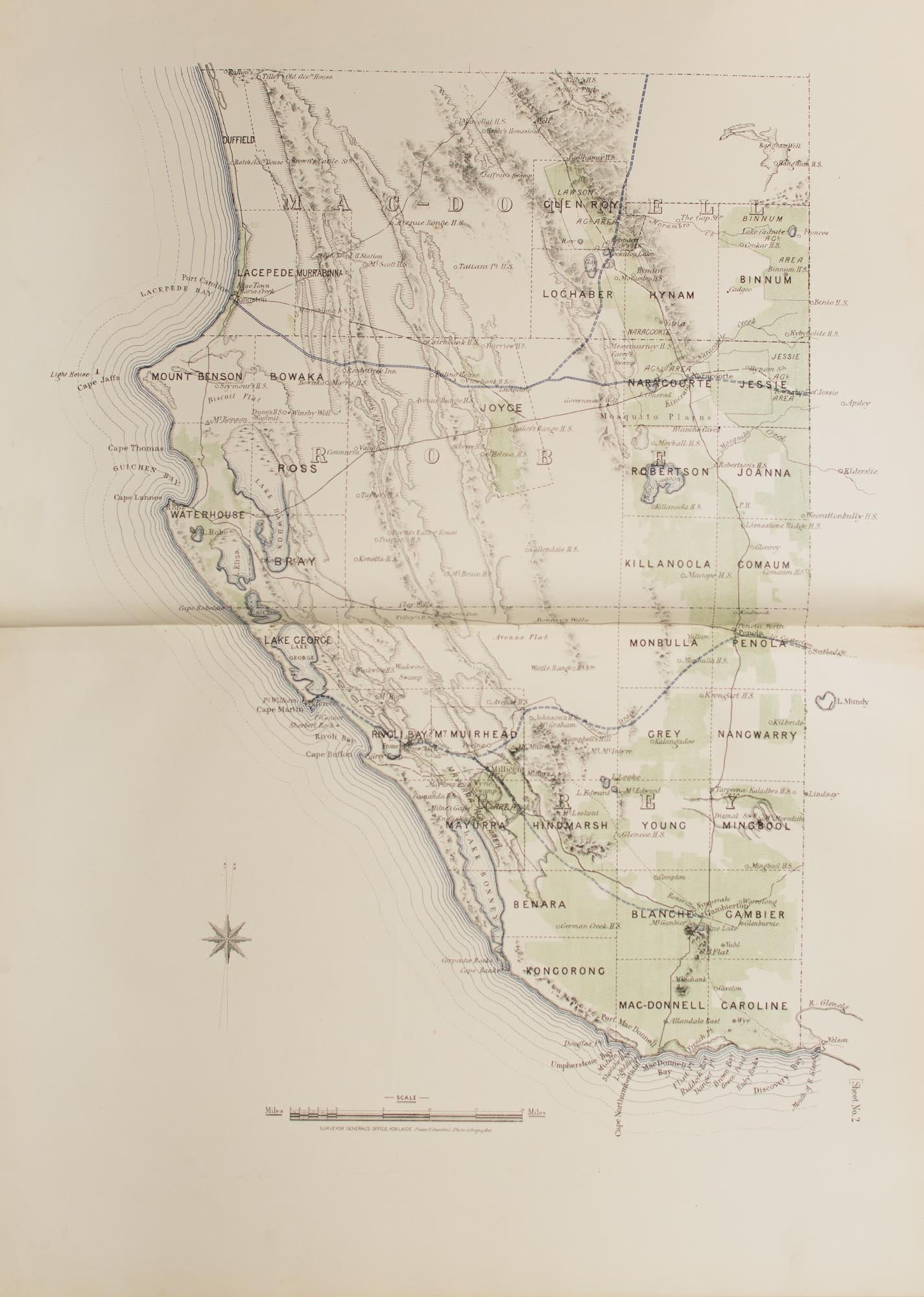
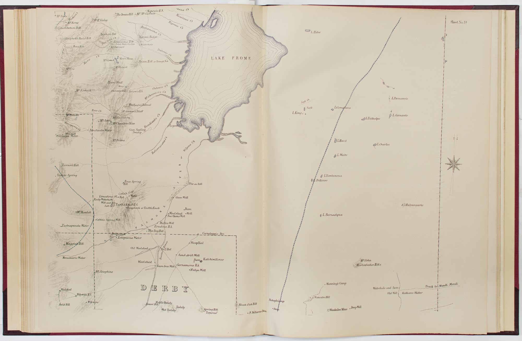
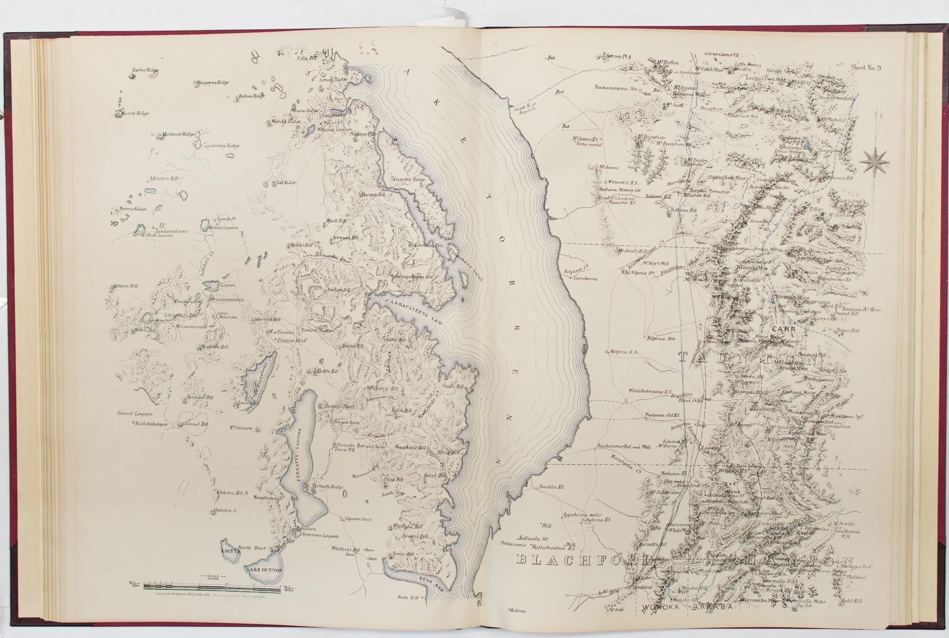
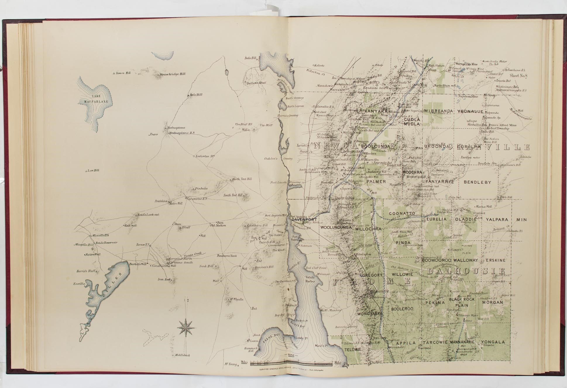
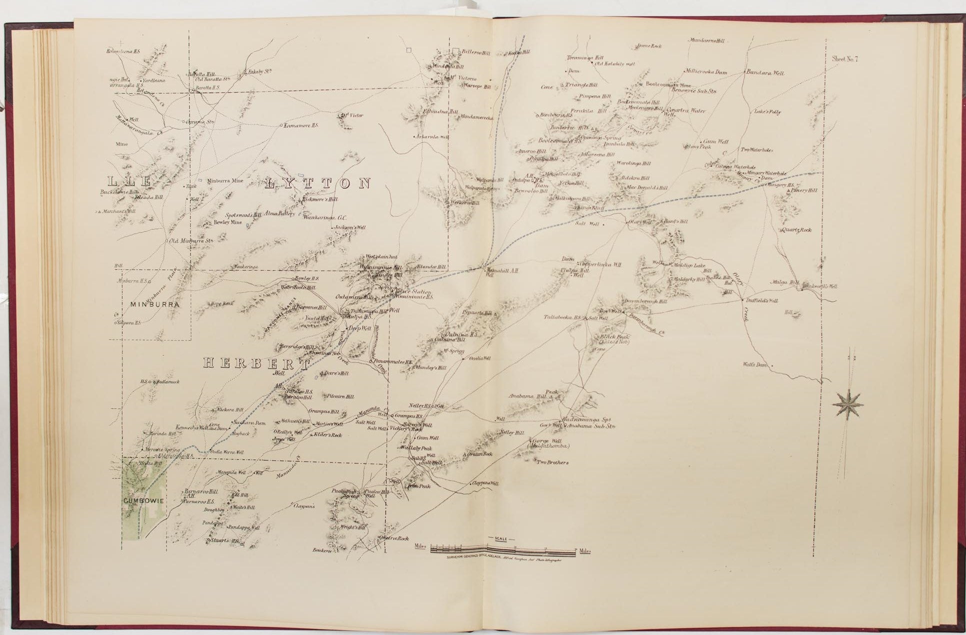
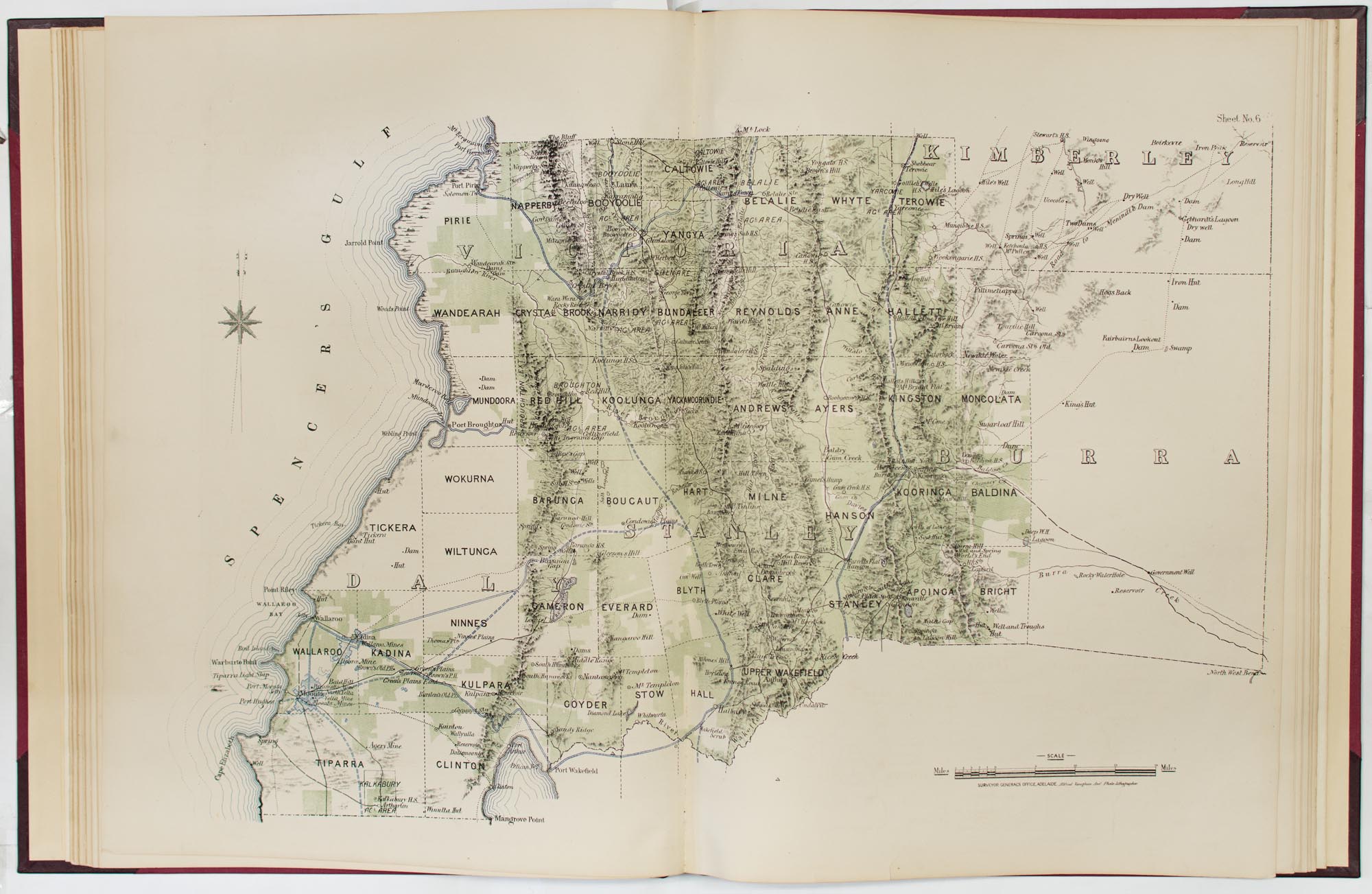
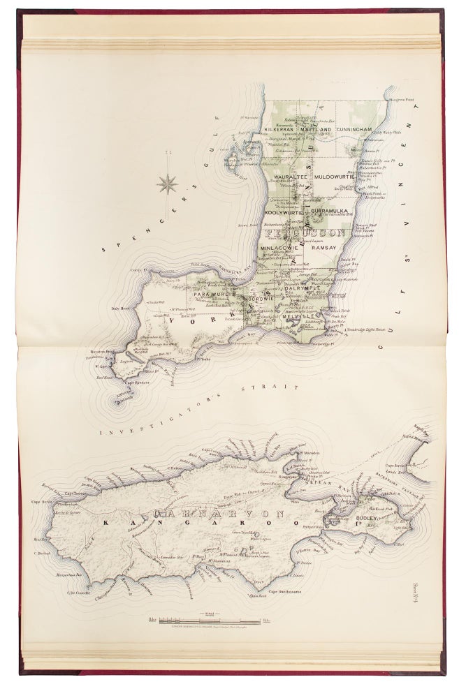
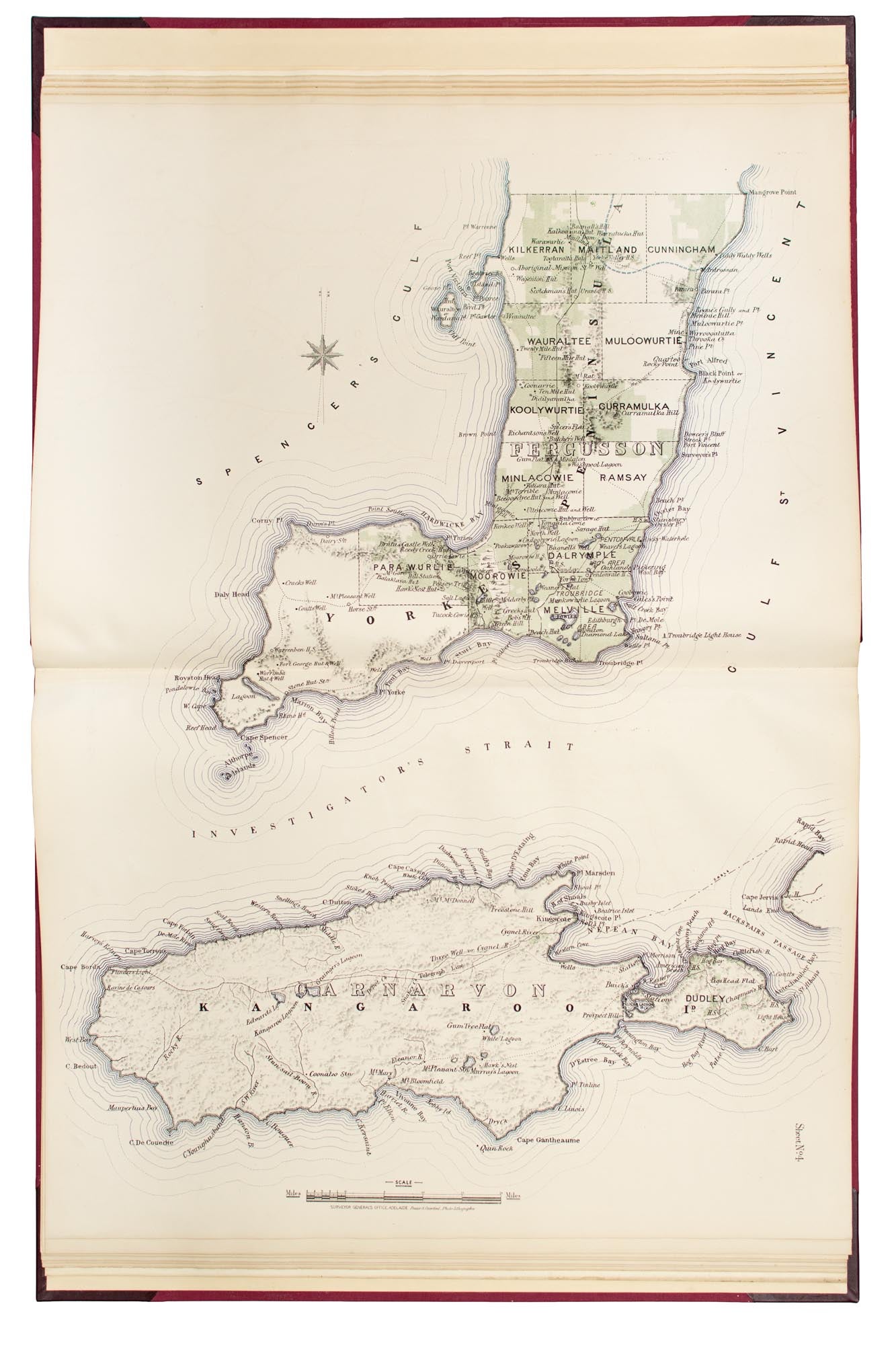
Plan of the Southern Portion of the Province of South Australia as divided into Counties and Hundreds, showing the most Important Settlements, Post Towns, Telegraph Stations, Main Roads, Railways &c. Compiled from Official Documents in the Office of the Surveyor General
Adelaide, Surveyor General's Office, 1877 [but 1878].
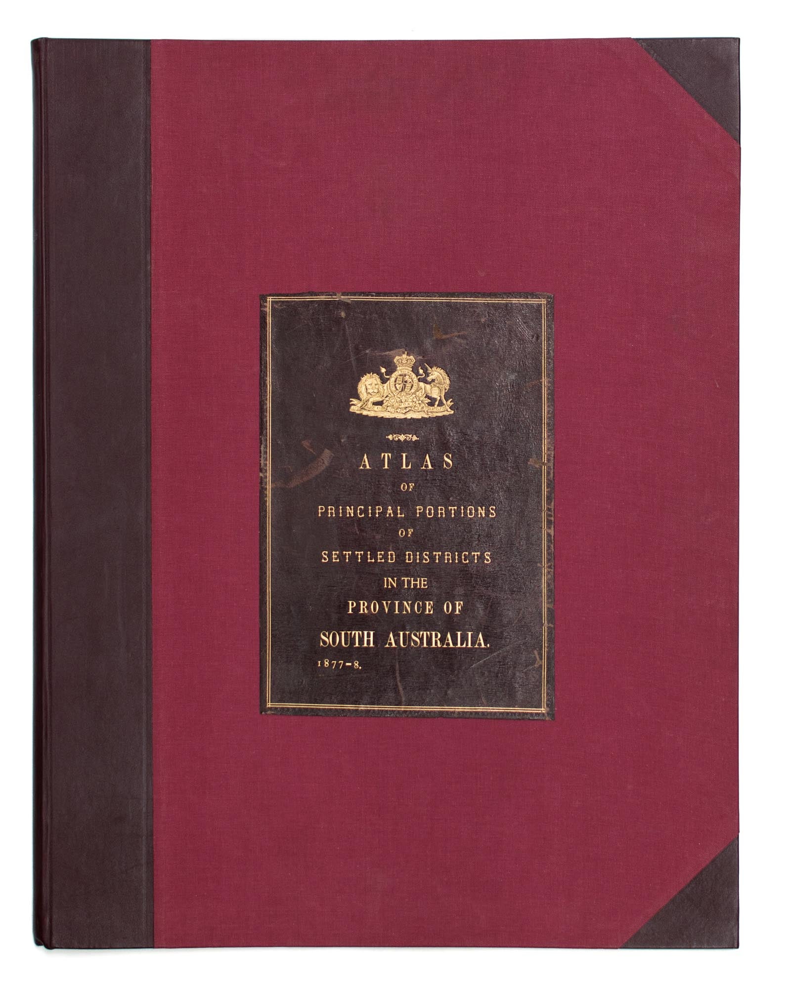
Elephant folio, [78] pages (title, key to maps plus 17 maps, all double-page, three-colour, and printed rectos only).
Modern half calf and cloth (a replica of the original binding) with the very large original leather title-label on the front cover (310 × 220 mm, lettered in gilt 'Atlas of Principal Portions of Settled Districts in the Province of South Australia, 1877-8'); tiny light mark to the spine; two short marginal tears expertly sealed; a very rare and impressive atlas in very fine condition - one could not hope to find a better copy.
Lithographed throughout by Frazer S. Crawford (Government Printer); signed on the double-page title 'G.W. Goyder Sur Genl 30/5/78' with a two-digit number (42 in this case) in his hand under the date - presumably the copy number of what we suggest was a very limited print run, given the lavishness of the production. [Over the decades, we have previously sold copies 34 and 50, both signed by Goyder on the same date.] The atlas was prepared under the direction of the man who, as Surveyor-General from 1861 to 1894, 'served under 24 different Commissioners of Crown Lands, through 34 changes of Ministry and helped to amend over 60 land acts' ('Australian Dictionary of Biography').
Item #115092
Sold