
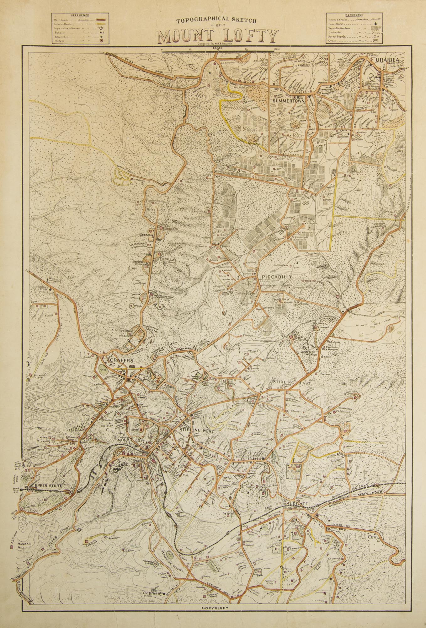
Topographical Sketch of Mount Lofty. Compiled by W.H. Edmunds
[Adelaide], The Compiler, [circa 1928].
A colour map printed on paper, mounted at an early date on stiff cardboard; external dimensions 660 × 455 mm, main printed surface 590 × 405 mm.
Top and bottom margins a little creased or cracked (this possibly occurred when the map was laid down); some light marginal discolouration near the top margin, clear of the printed surface; cardboard a little bowed; overall an attractive map in very good condition.
Trove records a single copy of three different sizes of this map, held by only one institution, the State Library of South Australia. This example appears to conform with the largest one, described by the SLSA thus: 'Scale [ca. 1:8,282] ... Topographical map of Mt. Lofty Ranges region with relief shown by hachures and form lines. Details include good and inferior roads, petrol supply and motor repairers, railway line and names of property owners. Covers Crafers, Upper Sturt, Heathfield, Aldgate, Stirling East, Stirling West and Mount Lofty. Copy of original'. In 1926, Edmunds published 'Topographic Maps of South Australia'; it contained six maps, not including this one. The introductory leaf of text in that item is worth quoting for the record: 'These maps are to be issued in sets of six at short intervals. They will comprise all parts of the State, and the remotest Districts will be included. The further the District is from the Capital the more minute will be the detail supplied. The maps are all made to join up with those adjacent so that a complete wall-map may be built up as the various sets are made available. The first set comprising the Adelaide Hills has a limited issue, and those who wish to have complete wall-maps as well as the sets in Book-form are advised to secure special mounting copies without delay'. The maps (identical in copies inspected, albeit in different order) are Semaphore (#1), Henley (#4), Brighton (#7), Millbrook (#2), Uraidla (#5) and Aldgate (#8). No further maps were published in that series.
Item #113465
Sold