Gregory's Street Directory of Adelaide and Suburbs. Limited Edition Reprint of ... 1st Edition (1936)
[No Place, No Publisher, No Date]/ 1936. Undated, but possibly produced in 1986, the year of South Australia's sesquicentenary. More
[No Place, No Publisher, No Date]/ 1936. Undated, but possibly produced in 1986, the year of South Australia's sesquicentenary. More
Boston, Ancient Egypt Research Associates, Inc., 2007. More
Macquarie Park, Universal Press, 1995. 'A Guide to Early Printed Maps of Australia, Antarctica and the South Pacific' (cover sub-title). More
London, Thames and Hudson, [1970s] (facsimile edition)/ 1645 and 1654. Number 26 of only 500 copies; with an introduction by R.V. Tooley. More
![Item #136838 The North Wales Coast [cover title]. Darlington's handbooks, Ralph DARLINGTON](https://treloars.cdn.bibliopolis.com/pictures/136838_01.jpg?width=320&height=427&fit=bounds&auto=webp&v=1698119170)
Llangollen, Darlington & Co., [1903-04]. More
Adelaide, Rigby Limited, 1976. The front free endpaper is inscribed ('With best regards on the first edition 12/4/77') and signed by the author. More
[London, Printed for T. Woodward (and others), 1744]. The first dedicated English map of Australia, originally issued as part of the second edition of John Harris's 'Navigantium atque Itinerantium Bibliotheca, or, a Complete Collection of Voyages and Travels' (London, 1744-1748); 'Vol. 1, page 325' is printed in the top right-hand..... More
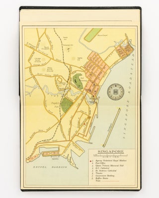
[Amsterdam, Nederland Royal Mail Line Amsterdam, after 1932]. The maps include: Batavia, Singapore, Belawan, Sabang, Colombo, and Ceylon; the sky charts depict the constellations (Northern and Southern Hemispheres, and Equatorial). More
London, William & Robert Chambers, 1888 to 1892 (second edition, extensively revised). 'Special regard has been given to American and Colonial subjects. The more important articles on matters connected with America have been written in the United States by American authors expressly for this edition. In subjects where the American..... More
Adelaide, W.C. Cox, Government Printer, 1860. South Australian Parliamentary Paper Number 25 of 1860. The steamer sank without loss of life after having initially struck on the eastern bank of the Channel after leaving Goolwa. A re-survey of the mouth of the Murray was organized; the accompanying chart is overprinted..... More
Bethesda, Defense Mapping Agency Hydrographic/ Topographic Center, 1995 [revised edition]/ 1958 (revised edition)/ 1802. 'The present volume retains the basic format of the revised 1958 version, but reorganizes the subjects, deletes obsolete text, and adds new material to keep pace with the extensive changes in navigation that have taken place..... More
Istanbul, Ekip Film, 2005. More
Box Hill, The Author, 1992. The author spent more than 28 years with National Mapping, retiring in 1976 as Director Designate of the Division of National Mapping. More
London, Printed for C. Smith, Mapseller Extraordinary to his Royal Highness the Prince of Wales, 1809. An attractive Georgian atlas 'on a Scale sufficiently large for the Purposes of general Reading, and yet not too inconvenient for the Study, or the Table' (advertisement at the foot of the contents page)..... More
Sydney, The Sydney Harbour Trust Commissioners, 1919. Four of the folding maps are superb bird's-eye views, from artwork by William Henry Withers. Details of these evocative illustrations are as follows; it is scarcely any wonder that copies of this work are rarely found intact. (1) 'Birds Eye View of the..... More
London, Countrywide Editions, 2005. A serious 'first attempt to present in chronological order an account' of the mapping of the 'larger Southeast Asian region to which the true Spice Islands belong, from classical times through to the beginning of the nineteenth century'. Not stated, but limited to 1500 copies, and..... More
Canberra, Government Printer, 1928 and 1929. Commonwealth Parliamentary Papers Number 222 of 1926-27-28 (only 835 copies), and Number 15 of 1929 (Second Session) (only 840 copies). The Commission, empowered to function from the proclamation of the Northern Australia Act of 1926 on 1 February 1927 (resulting in the proclamation of..... More
![Item #112434 Proposed New Hundred and Agricultural Area [in Portion of Kangaroo Island]. Kangaroo...](https://treloars.cdn.bibliopolis.com/pictures/112434_01.jpg?width=320&height=427&fit=bounds&auto=webp&v=1573024072)
Adelaide, W.C. Cox, Government Printer, 1870. The areas under discussion are near Kingscote. South Australian Parliamentary Paper Number 216 of 1870. More
![Item #114835 The West Point Military History of The Second World War. [Comprising] Europe and the...](https://treloars.cdn.bibliopolis.com/images/noimage.png?auto=webp)
Wayne, Avery Publishing Group, 1989. Not least, the atlas contains 135 pages of detailed colour maps. More
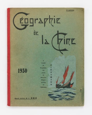
Zi-Ka-Wei [near Shanghai], Imprimerie de l'Orphinat de T'ou-Se-We, 1930 [second edition]/ 1929. Loosely inserted are three contemporary maps in French, neatly hand-drawn and hand-coloured in outline, of China, Indo-China and the French colonies in the Pacific, and a printed map in English, removed from another book, showing the coast and..... More
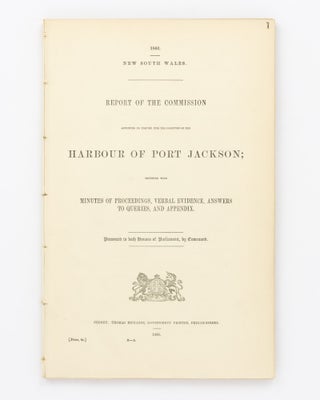
Sydney, Thomas Richards, Government Printer, 1866. New South Wales Parliamentary Paper 9-A of 1866. The Commission, headed by Commander Frederic William Sidney RN, was appointed to 'inquire and report on the present condition of the Harbour of Port Jackson, and particularly into the changes which have taken place in the..... More
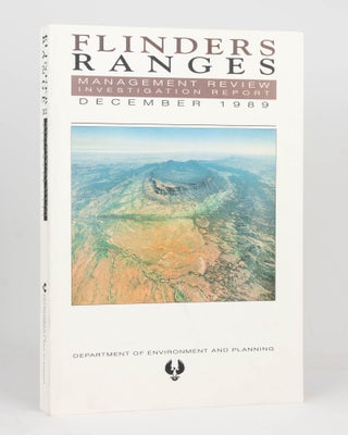
Adelaide, South Australian Department of Environment & Planning, 1989. More
London, Times Books/ Harper Collins, 1991. More
The Rocks/ Sydney, International Cultural Corporation of Australia/ Art Gallery of New South Wales, 1988. More
Adelaide, R.E.E. Rogers, Government Printer, 1912 [and] 1913. The ownership signature of Arthur Searcy (1913) is written in pencil on each title page. Arthur Searcy (1852-1935) was Controller of Harbors from July 1911 and Chairman of the Harbors Board Committee until his retirement at the age of 65 (information from..... More