![Item #131905 Topographic Maps of South Australia [cover title]. Maps: South Australia, William Herbert EDMUNDS.](https://treloars.cdn.bibliopolis.com/pictures/131905_01.jpg?width=768&height=1000&fit=bounds&auto=webp&v=1669591424)
![Topographic Maps of South Australia [cover title]](https://treloars.cdn.bibliopolis.com/pictures/131905_02.jpg?auto=webp&v=1669591424)
![Topographic Maps of South Australia [cover title]](https://treloars.cdn.bibliopolis.com/pictures/131905_03.jpg?auto=webp&v=1669591424)
![Topographic Maps of South Australia [cover title]](https://treloars.cdn.bibliopolis.com/pictures/131905_04.jpg?auto=webp&v=1669591424)
![Topographic Maps of South Australia [cover title]](https://treloars.cdn.bibliopolis.com/pictures/131905_05.jpg?auto=webp&v=1669591424)
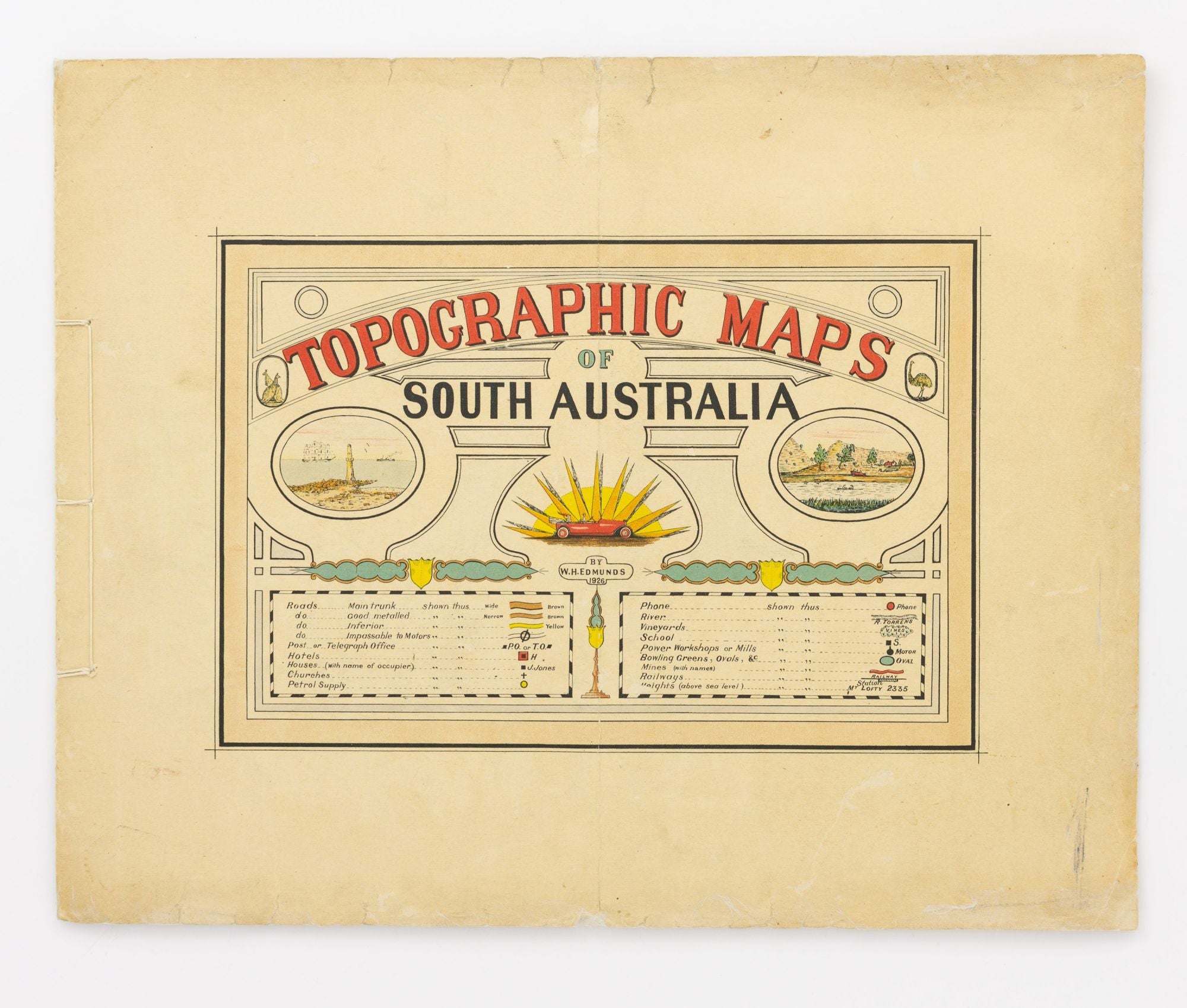
Topographic Maps of South Australia [cover title]
[Adelaide, The Compiler], 1926.
External dimensions 317 × 405 mm, with 6 colour maps (298 × 375 mm), printed rectos only.
Overlapping colour-pictorial title-wrappers with the contents bound in with thin cord; expert restoration to some short tears and chips to the edges of the wrappers; one vertical crease down the centre of the entire publication; overall an excellent copy.
The copy in the State Library of South Australia has a presentation inscription on the front cover 'by the author'. It also contains an introductory leaf of text which is worth quoting: 'These maps are to be issued in sets of six at short intervals. They will comprise all parts of the State, and the remotest Districts will be included. The further the District is from the Capital the more minute will be the detail supplied. The maps are all made to join up with those adjacent so that a complete wall-map may be built up as the various sets are made available. The first set comprising the Adelaide Hills has a limited issue, and those who wish to have complete wall-maps as well as the sets in Book-form are advised to secure special mounting copies without delay'. The pictorial front cover incorporates the legend and a few attractive vignettes, as well as the title. The maps (identical in all copies we have inspected, albeit occasionally in different order to this one) are Semaphore (#1), Henley (#4), Brighton (#7), Millbrook (#2), Uraidla (#5), and Aldgate (#8). No further maps were published. A short article relating to Edmunds appeared in 'The Mount Barker Courier and Onkaparinga and Gumeracha Advertiser' on 22 December 1933: 'Capt. W. H. Edmunds VD (late of the Australian Light Horse) has for the past 25 years been engaged in the preparation of topographical maps of many parts of South Australia (as a hobby) ... [He] writes that he is considerably hampered owing to many inquiries as to his movements and he asks us to point out the advantages of a good map of the district. He would like residents to give assistance in his work by giving what information they can; that they name their houses and farms, as it is unlikely that another map will be produced for many years'.
Item #131905
Sold