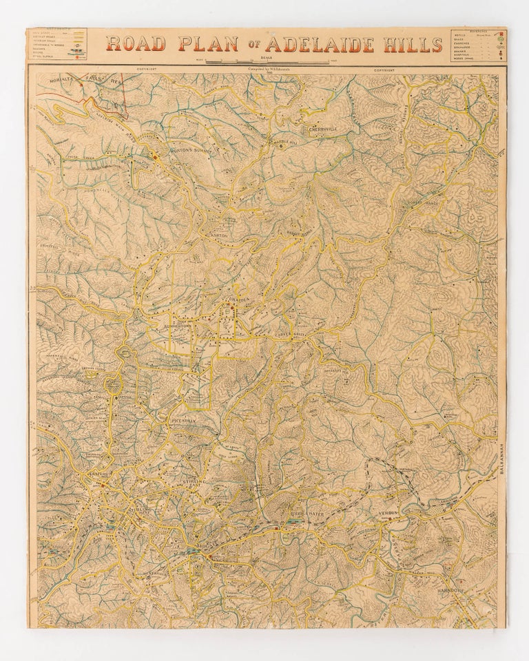
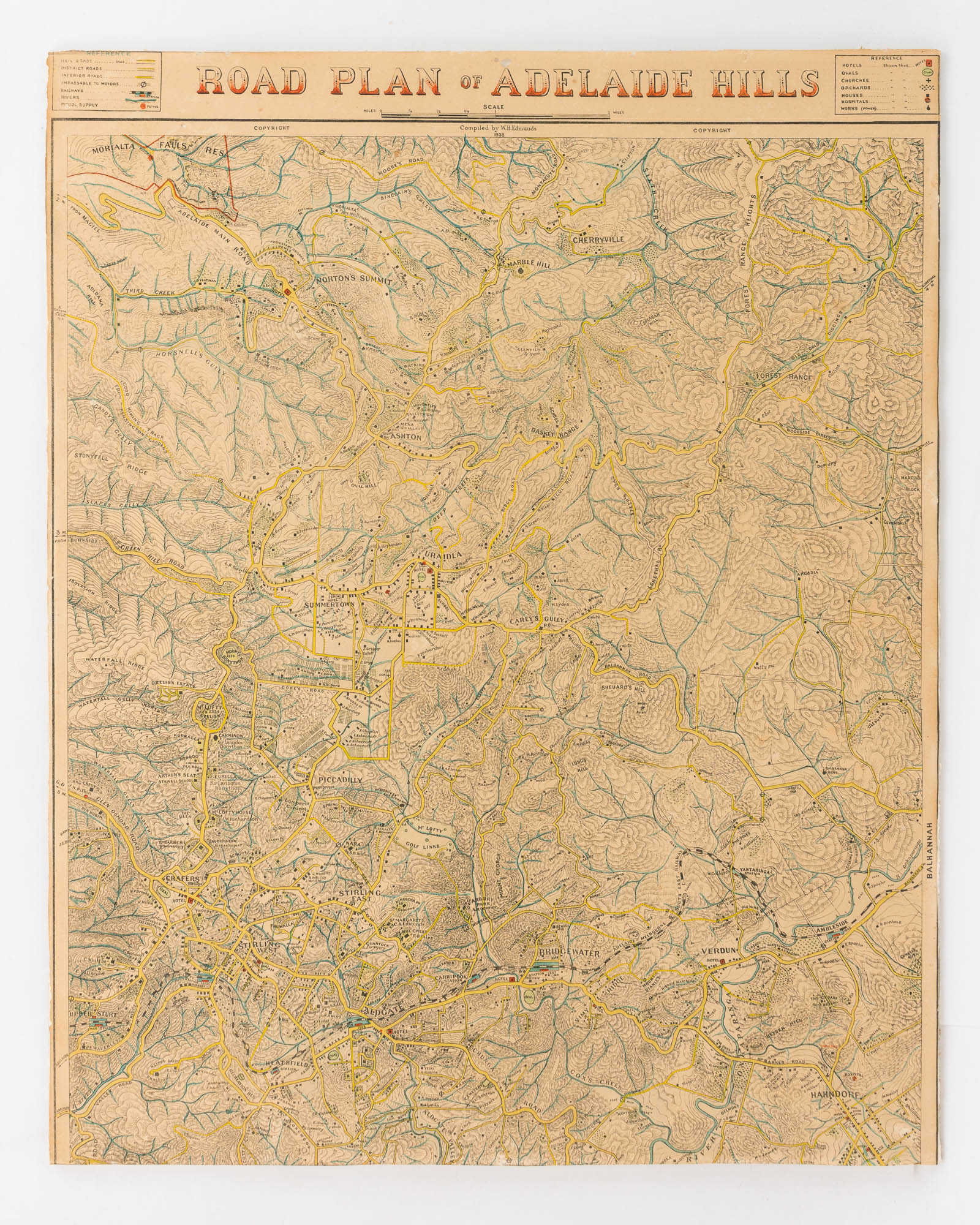
Road Plan of Adelaide Hills
[Adelaide], W.H. Edmunds, 1938.
A colour-printed map on paper (approximately 506 × 400 mm), trimmed to the printed borders left and right, and to just above the printed title and legends on the top edge, with about 30 mm of printed surface cropped from the bottom edge.
Slight imperfections to the title (a few tiny chips and trifling loss to silverfish); overall in very good condition.
'Topographic map of Adelaide Hills from Morialta Falls, Forest Range Heights in the north and Mylor in the south. Includes Norton's Summit, Cherryville, Ashton, Uraidla, Carey's Gully, Piccadilly, Crafers, Stirling, Aldgate, Bridgewater, Hahndorf, Heathfield, Longwood and Mylor. Shows hotels, ovals, churches, orchards, schools and works. Relief shown by hachures. Includes names of property owners' (from the State Library of South Australia's catalogue record on Trove). Notwithstanding the loss of Loftia Park, Iron Bark, Longwood and Mylor, this is still an attractive example of a rare parochial map. A short article relating to Edmunds appeared in 'The Mount Barker Courier and Onkaparinga and Gumeracha Advertiser' on 22 December 1933: 'Capt. W. H. Edmunds VD (late of the Australian Light Horse) has for the past 25 years been engaged in the preparation of topographical maps of many parts of South Australia (as a hobby) ... [He] writes that he is considerably hampered owing to many inquiries as to his movements and he asks us to point out the advantages of a good map of the district. He would like residents to give assistance in his work by giving what information they can; that they name their houses and farms, as it is unlikely that another map will be produced for many years'.
Item #123762
Sold