![Item #121923 Plan de la Ville de Sydney, Capitale des Colonies Anglaises aux Terres Australes. Levé par Mr Lesueur et assujetti aux relevemens de Mr Boullanger, 9bre [Novembre] 1802. Map: Sydney.](https://treloars.cdn.bibliopolis.com/pictures/121923_01.jpg?width=768&height=1000&fit=bounds&auto=webp&v=1607496332)
![Plan de la Ville de Sydney, Capitale des Colonies Anglaises aux Terres Australes. Levé par Mr Lesueur et assujetti aux relevemens de Mr Boullanger, 9bre [Novembre] 1802](https://treloars.cdn.bibliopolis.com/pictures/121923_02.jpg?auto=webp&v=1607496332)
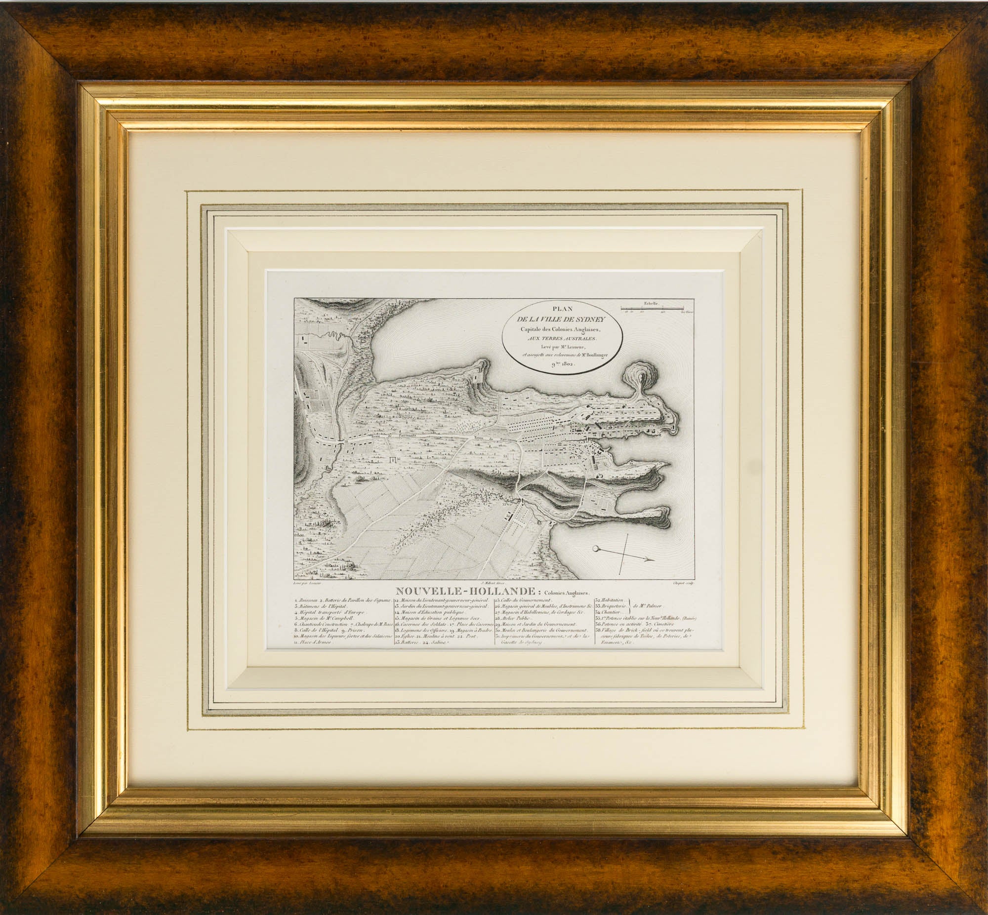
Plan de la Ville de Sydney, Capitale des Colonies Anglaises aux Terres Australes. Levé par Mr Lesueur et assujetti aux relevemens de Mr Boullanger, 9bre [Novembre] 1802
[Paris, 'Levé par Lesueur., J. Milbert direx., Cloquet sculp.', 1824].
An engraved map elaborately matted (obscuring the printer's imprint below the key and the plate number 17 in the top right-hand corner; visible image size 197 × 240 mm), framed and glazed (external dimensions 470 × 510 mm). A couple of very faint spots of foxing; in excellent condition.
A handsomely-presented example of this early French map of Sydney, from the published account of the Baudin expedition of 1800-3. This version comes from the atlas to the second edition of 1824. It contains significantly more detail than the version found in the first edition of 1811, and is a more attractive presentation overall. In 'Framing New Holland or framing a narrative? A representation of Sydney according to Charles-Alexandre Lesueur' (Framing French Culture, 2015), Jean Fornasiero traces the development of this image, a hybrid produced from charts by the expedition's hydrographer, Charles Boullanger, and Lesueur's more impressionistic watercolour (he was, after all, the expedition's artist, and better known for his views and natural history plates).
Item #121923
Price (AUD):
$1,500.00