![Item #116541 Stirling District EFS [Emergency Fire Service]. Map.](https://treloars.cdn.bibliopolis.com/pictures/116541_00.jpg?width=768&height=1000&fit=bounds&auto=webp&v=1585898147)
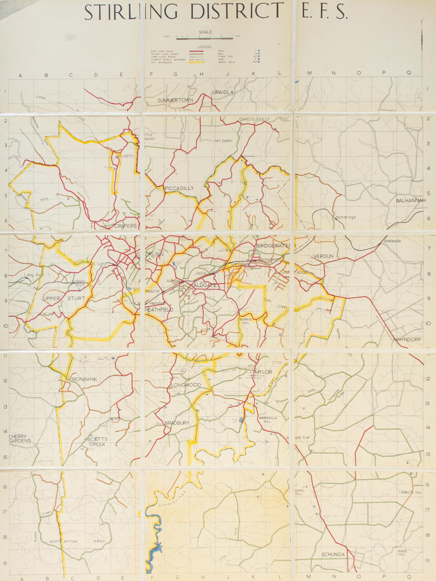
Stirling District EFS [Emergency Fire Service]
[Adelaide], Emergency Fire Service, [1970s?].
Total external dimensions 1340 × 1010 mm, a hand-coloured processed map professionally cut into 15 uniform panels (each 258 × 330 mm) and mounted on linen; in fine condition.
As 'part of the Second World War effort, the [South Australian] government established and equipped volunteer Emergency Fire Service (EFS) Brigades. These were established in Adelaide first and later in some country areas. After the war, the government lent equipment from these groups to District Councils for rural firefighting work. An Emergency Fire Services operation within the Police Department was formed to supervise the program. Gradually the main local council brigades began to feel part of a state-wide service. From the mid-1950s the EFS organisations grew stronger and volunteers began to campaign for EFS to be established as a statutory authority. In 1976, the government passed the Country Fires Act, which set up the SA Country Fire Service (CFS)' (SA Government information online). Running clockwise from the top, the main towns in the district covered here are Summertown and Uraidla in the north, Balhannah and Hahndorf in the east, Echunga and Mt Bold Reservoir in the south, and Cherry Gardens and Upper Sturt in the west.
Item #116541
Sold