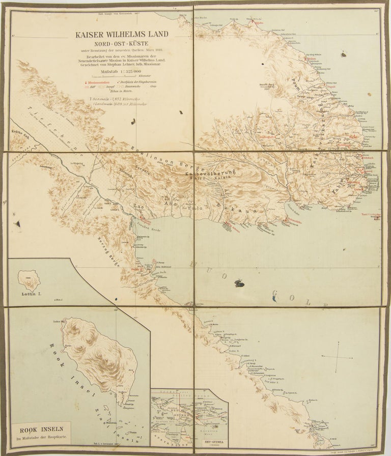
Kaiser Wilhelms Land, Nord-Ost-Kuste unter Benutzung der neuesten Quellen: Marz 1910. Bearbeitet von den ev. Missionaren Neuendettelsauer Mission in Kaiser Wilhelms Land. Gezeichnet von Stephan Lechner, luth. Missionar
Leipzig, Geographischen Anstalt von Velhagen & Klasing, March 1910.
A colour map on paper (printed surface approximately 620 × 523 mm), dissected into six large panels and mounted on cloth, folding down to 215 × 275 mm (possibly not as issued, but down expertly and contemporaneously).
A few light waterstains and small inkspots; imperial to metric distances conversion scale added in neat manuscript; overall in very good condition.
'Kaiser-Wilhelmsland, North-East Coast using the latest sources: March 1910. Edited by the Evangelical Missionary Neuendettelsau Mission in Kaiser-Wilhelmsland. Drawn by Stephan Lechner, Lutheran Missionary'; the numerous mission stations are printed in red. There is a large inset map of Rook Island, and a much smaller one of New Guinea and North Australia (on which the mission station at Elim, near Cooktown, is marked). The only example of a map with this title in Trove is in the State Library of NSW: it is described as '[75 × 100] cm' and 'Scale not given', with one inset map of Rook Island. It is either a variant, or more likely, inaccurately described.
Item #115401
Sold