![Item #113571 Philips' Series of Travelling Maps. New Zealand, by W. Hughes, F.R.G.S. [cover title]. Map: New Zealand.](https://treloars.cdn.bibliopolis.com/pictures/113571.jpg?width=768&height=1000&fit=bounds&auto=webp&v=1594012013)
![Philips' Series of Travelling Maps. New Zealand, by W. Hughes, F.R.G.S. [cover title]](https://treloars.cdn.bibliopolis.com/pictures/113571_2.jpg?auto=webp&v=1594012013)
Philips' Series of Travelling Maps. New Zealand, by W. Hughes, F.R.G.S. [cover title]
London, George Philip and Son, [circa 1877?].
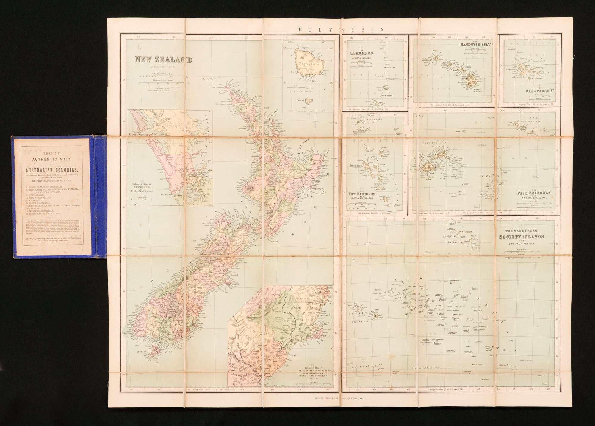
A full-colour map (printed surface 507 × 630 mm), dissected into 24 sections and mounted on linen, folding down to 165 × 110 mm and case-mounted, with a publisher's advertisement ('Philips' Authentic Maps of the Australian Colonies') on the front pastedown.
Blue stippled cloth lettered and decorated in gilt on the front cover, with the publisher's logo in blind at the rear; cloth sunned on the spine, a little rubbed and marked, and lacking the two cloth ribbon ties from the leading edges; linen lightly foxed and marked on the blank verso; the map is in excellent condition.
The overall heading on the map is 'Polynesia', and there are in fact 10 individual maps (three of them inset on the map of New Zealand). Other areas featured include the Galapagos, Sandwich, Mariana, New Hebrides, Friendly and Society Islands. The National Library of Australia has a map which may be identical in content (see MAP NK 10699), but a variant in form, being issued as one sheet, uncut and unmounted. The NLA also holds an earlier version (circa 1865), which has printed on the New Zealand map a list of native tribes and their locations (MAP RM 493).
Item #113571
Sold