
A souvenir handkerchief featuring a map centred on Turkey and the Black Sea
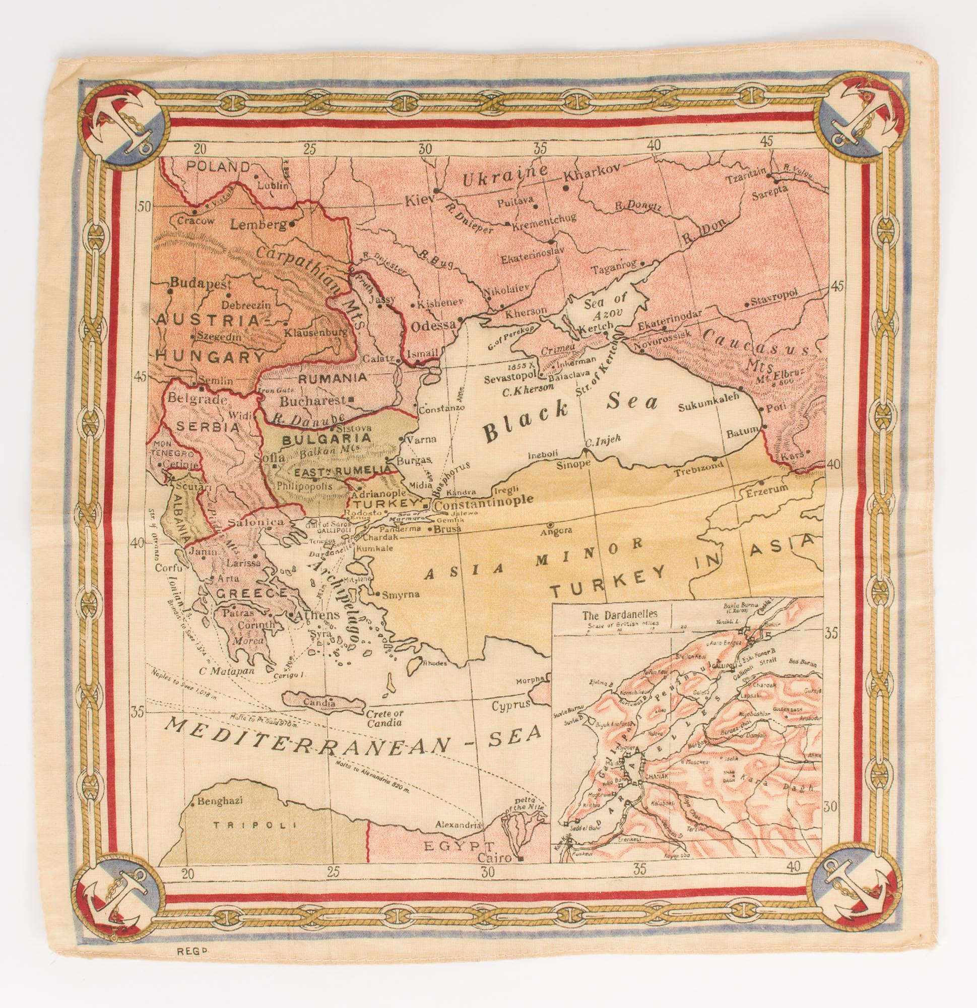
The linen handkerchief is printed in full colour; the external dimensions are 310 × 305 mm, with the map itself 255 × 240 mm. It is surrounded by a decorative border with nautical motifs. Apart from the abbreviation 'Regd.' in the bottom left-hand corner below the border, there is no indication of its origins. However, the presence of sea-routes in the Mediterranean and Black Seas, and the nautical border, suggest it may have been issued by a shipping company. The top portion of the map shows southern Europe from Cracow in Austria-Hungary to Tzaritzin (Stalingrad from 1925-1961, now Volgograd) in Russia, with the Balkan Peninsula on the left, the northern tip of Africa below it, and a large inset map (92 × 88 mm) of the Dardanelles in the bottom right-hand corner. We suggest a date circa 1914; the map of Bulgaria shows clearly that the Second Balkan War has ended, and the First World War has not yet reached the Gallipoli Peninsula.
Item #112096
Sold