
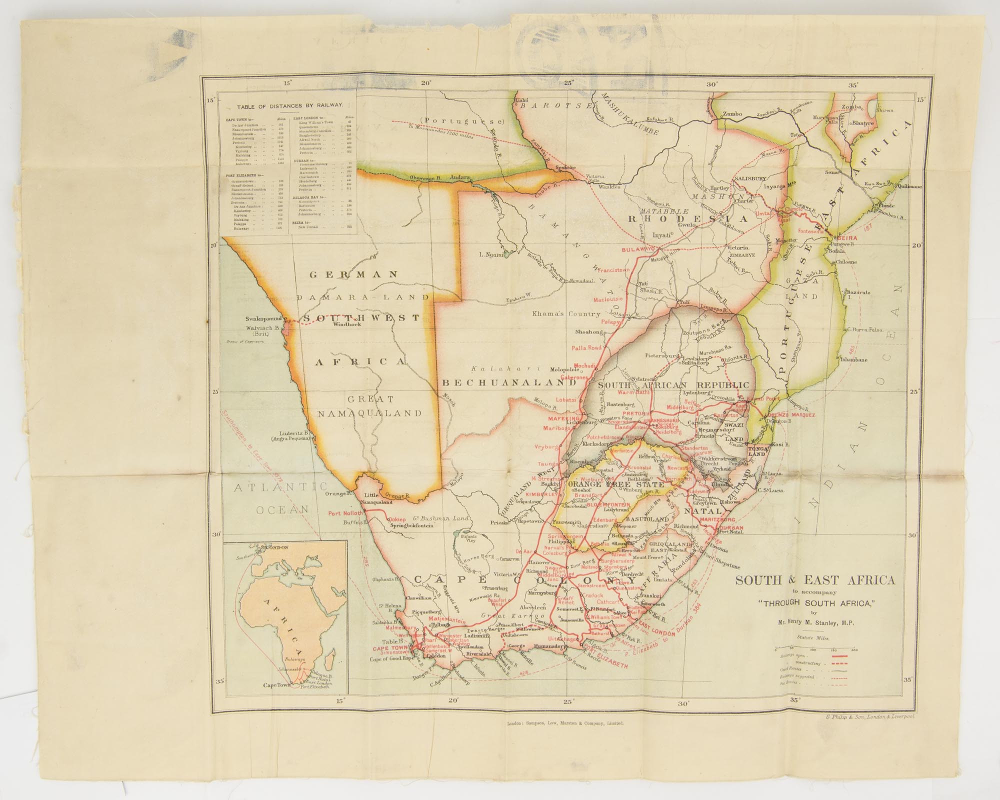
A colour map of 'South & East Africa to accompany "Through South Africa" by Mr. Henry M. Stanley, M.P.'
London, Sampson, Low, Marston & Company, Limited, [1898].
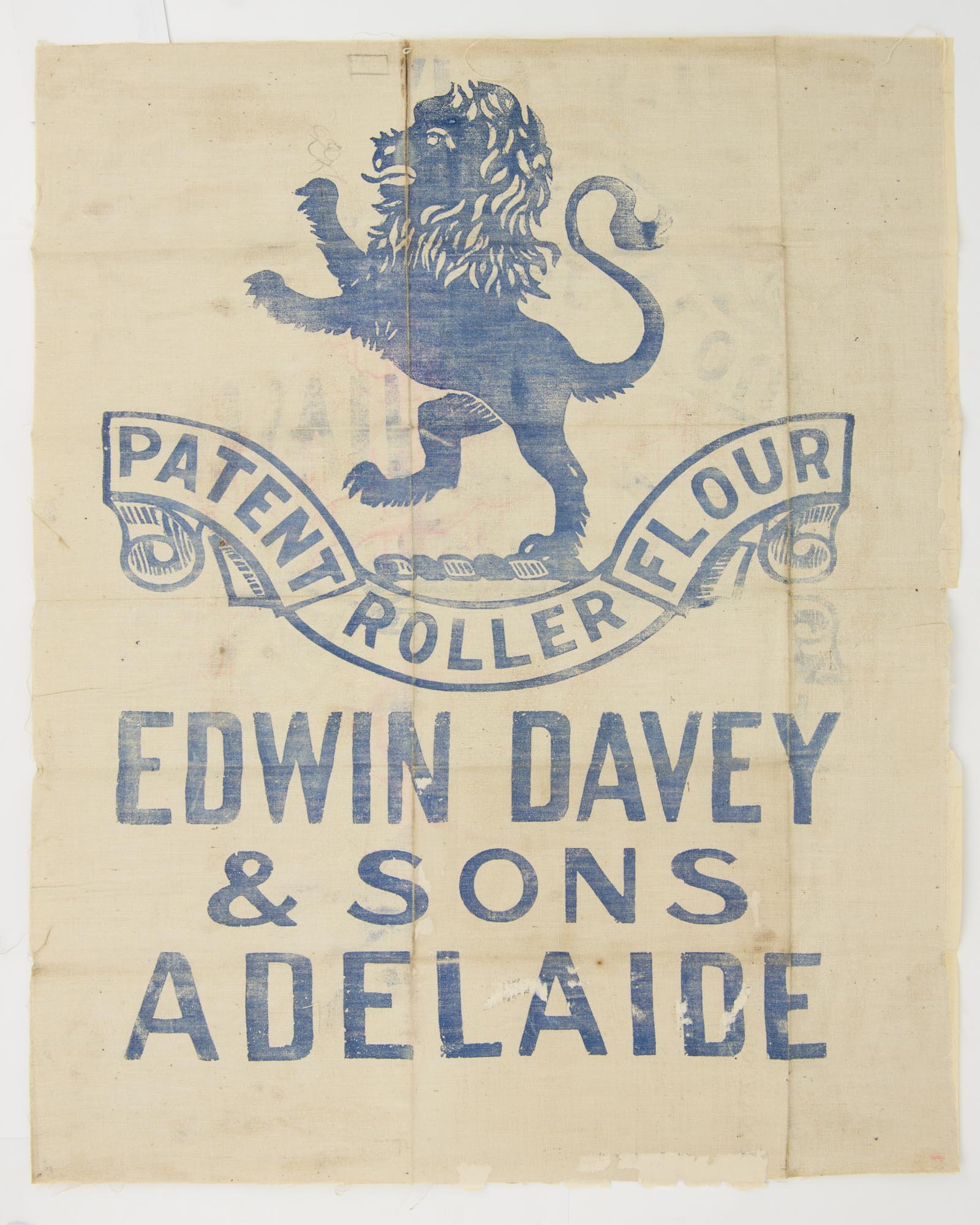
Printed surface 365 × 415 mm (overall paper size 435 × 540 mm), mounted on a printed linen flour bag ('Patent Roller Flour. Edwin Davey & Sons Adelaide', surmounted by a large lion rampant).
The map is folded as issued, albeit now lightly cockled in places; slight loss to both paper and cloth along the top margin (well clear of the printed surface), with a little bleed-through from the printed flour bag in the top margin, with minimal impact on the map; light mark along portion of one fold; overall an excellent copy.
The map, by 'G. Philip & Son, London & Liverpool', was removed from a copy of Stanley's book, published in 1898. The book came from the collection of Arnold Edwin Davey (1862-1920), well-known local flour-miller and grain merchant, one of the eponymous Sons of Edwin Davey. Prospective buyers please note: if you are only interested in the map, you can get it cheaper elsewhere.
Item #110982
Sold